787 Flight Crew Operations Manual
DO NOT USE FOR FLIGHT
Warning Systems -
System Description
Copyright © The Boeing Company. See title page for details.
15.20.24 D615Z003-TBC
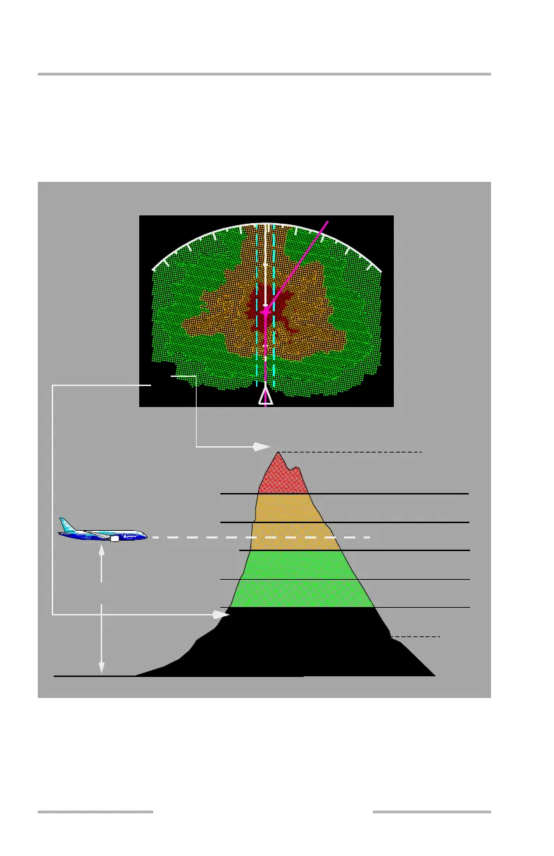
[Option – Lookahead peaks]
When obstacle and terrain contours are displayed, the altitudes of the highest and
lowest obstacles or terrain are displayed in hundreds of feet above sea level (MSL)
below the TERR indication. The color of each altitude corresponds to the color of
the respective contour.
[Option – Lookahead peaks]
REF ALTITUDE + 2000
REF ALTITUDE + 1000
REF ALTITUDE - 250/-500
REF ALTITUDE - 1000
REF ALTITUDE - 2000
REFERENCE
ALTITUDE
HIGH DENSITY RED
HIGH DENSITY YELLOW
LOW DENSITY YELLOW
HIGH DENSITY GREEN
LOW DENSITY GREEN
BLACK
(MAXIMUM ELEVATION NUMBER)
SEA LEVEL
(MINIMUM ELEVATION NUMBER)
Aircraft at Low Relative Altitude
20
TERR
144
052
MOUNT
9
1
2
1
5
August 14, 2009