787 Flight Crew Operations Manual
DO NOT USE FOR FLIGHT
Flight Instruments, Displays -
Navigation Displays
Copyright © The Boeing Company. See title page for details.
10.40.12 D615Z003-TBC
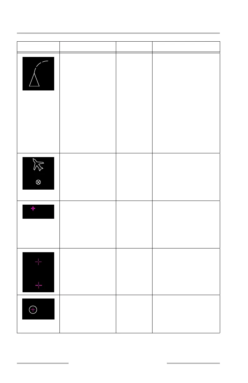
Symbol Name ND Mode Remarks
Position trend vector
(W) (dashed line)
MAP, MAP
CTR,
mini-map
Predicts position at the end
of 30, 60, and 90 second
intervals. Each segment
represents 30 seconds.
Based on bank angle and
groundspeed. Selected
range determines the
number of segments
displayed. For range:
• greater than 20 NM,
3 segments
• = 20 NM, 2
segments
• = 10 NM, 1 segment
Airplane symbol (W) PLAN Indicates actual position
and track along the flight
plan route.
Symbol changes to a circle
north of 82N latitude and
south of 82S latitude.
Waypoint: active (M),
inactive (W)
MAP, MAP
CTR, PLAN,
mini-map
Active – represents the
waypoint the airplane is
currently navigating to.
Inactive – represents the
waypoints on the active
route.
Pick waypoint (PICK
WPT) cursor (M)
MAP, MAP
CTR, PLAN
Displayed when the PICK
WPT key is selected. When
the cursor highlights a
waypoint, airport, or
navaid, the letters LAT and
LONG are removed.
Highlighted waypoint
(W)
MAP, MAP
CTR, PLAN
Displayed when a visible
route waypoint,
background waypoint,
airport, or navigation aid is
passed over by the cursor.
OR
AMBOY
LAT
LONG
OR
AMBOY
February 15, 2010