Services Location information
Digi Connect EZ Mini User Guide
383
c. For Radius, type the radius of the circle. Allowed values are an integer followed by
m or km, for example, 100m or 1km.
n If Polygonal is selected:
a. Click to expand Coordinates.
b. Click to add a point that represents a vertex of the polygon. A vertex is the point
at which two sides of a polygon meet.
c. Type the Latitude and Longitude of one of the vertices of the polygon. Allowed
values are:
l For Latitude, any integer between -90 and 90, with up to six decimal places.
l For Longitude, any integer between -180 and 180, with up to six decimal
places.
d. Click again to add an additional point, and continue adding points to create the
desired polygon.
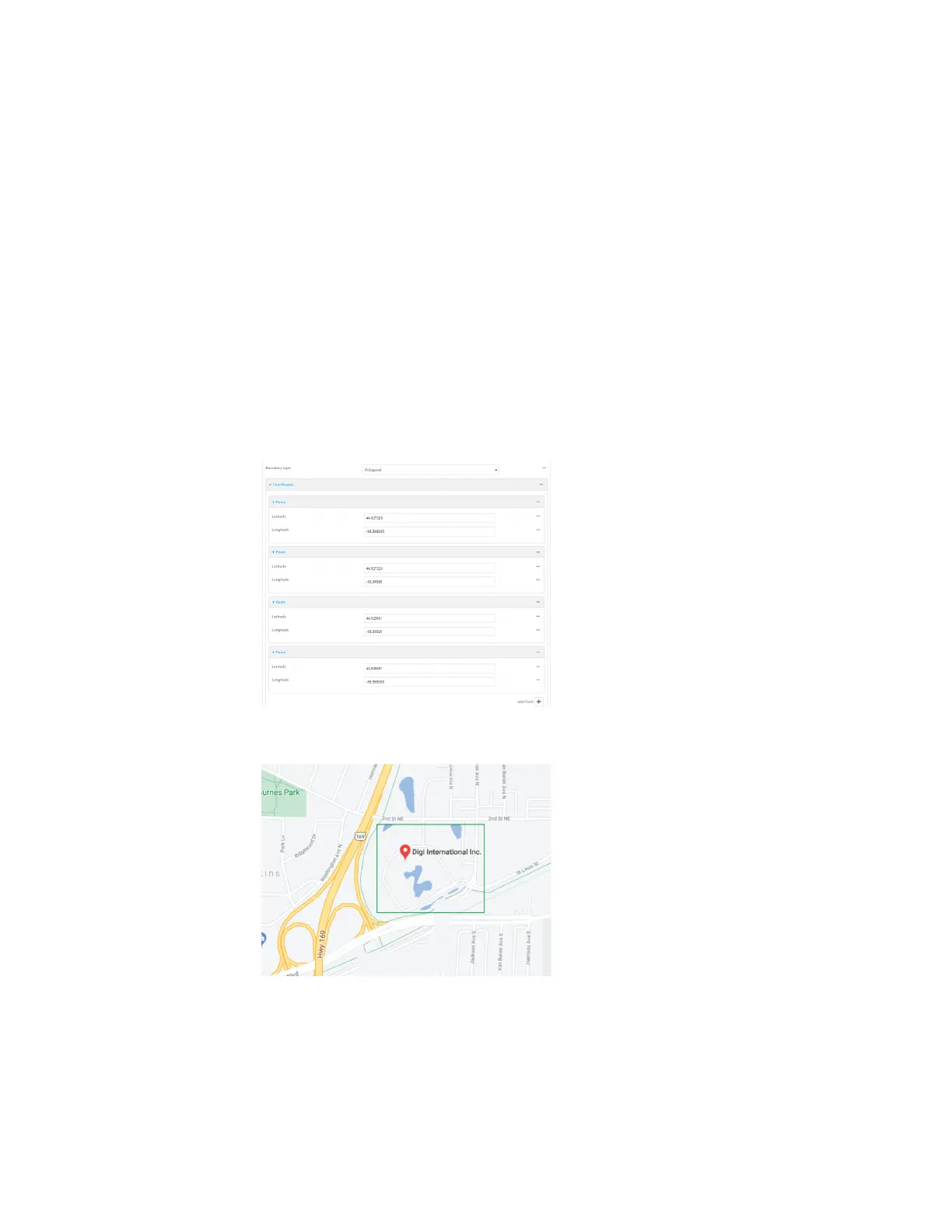
For example, to configure a square polygon around the Digi headquarters, configure a
polygon with four points:
This defines a square-shaped polygon equivalent to the following:
7. Define actions to be taken when the device's location triggers a geofence event:
n To define actions that will be taken when the device enters the geofence, or is inside
the geofence when it boots:
 Loading...