5. ROUTES
5-15
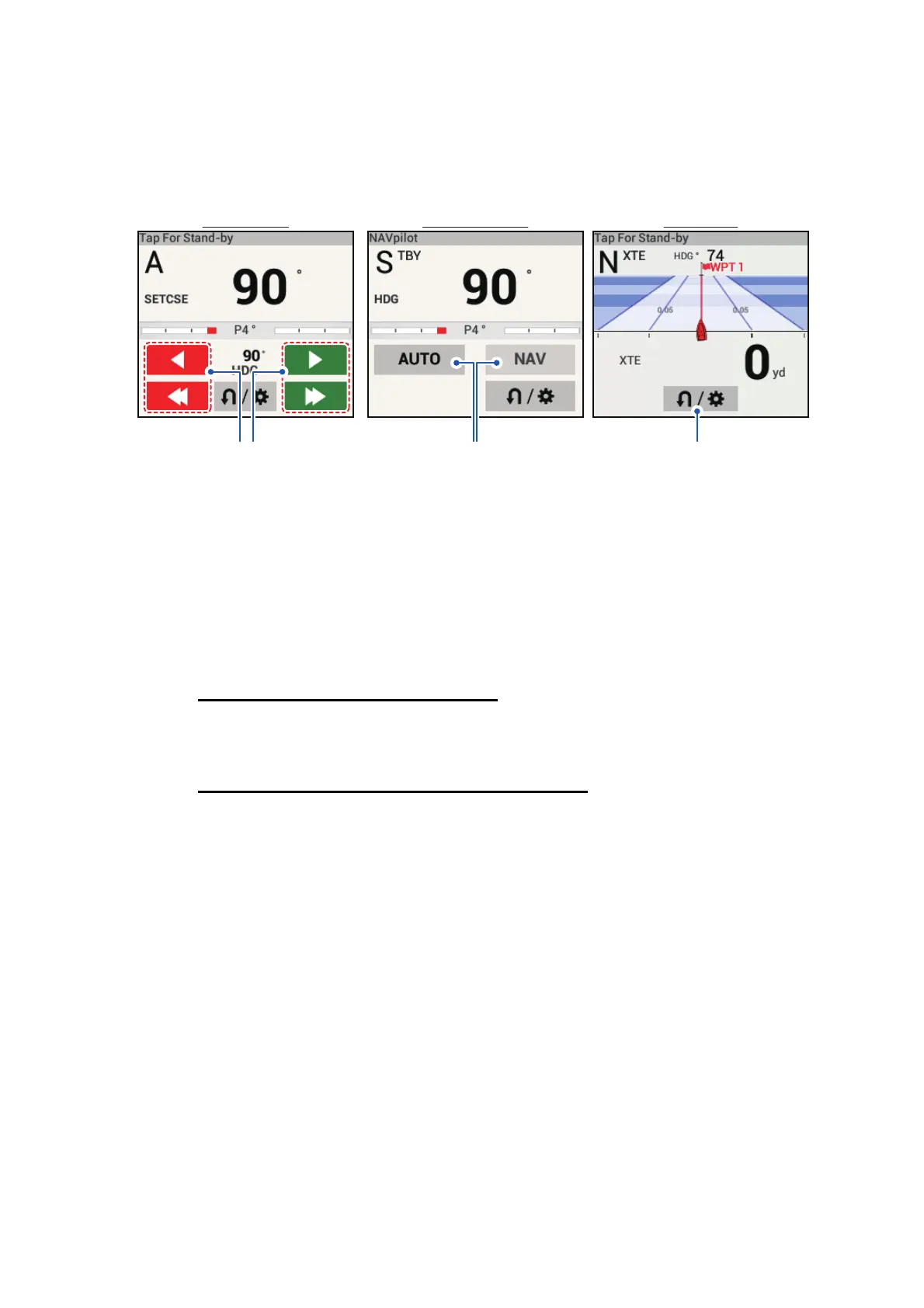
5.11.11 Steering a route with the NAVpilot
The NAVpilot can be used to steer a route, from the NAVpilot control box in the data
area. The figure belows shows the NAVpilot control box. See subsection 4.13.4 for de-
tails.
5.12 Fuel Level Indicators
This equipment provides indicators that show both the approximate location where
you may run out of fuel and the distance you can travel with the remaining fuel. This
function requires the NMEA 2000 sentence PGN127489 (Engine Fuel Rate).
Fuel max range indicator (on route)
The fuel pump icon marks on the current route how far you can travel on the remaining
fuel. To show this marker, tap [Settings][Routes][Fuel Max Range][ON].
Fuel range indicator (ring about own position)
The fuel range indicator draws a circle about own ship, the radius of the circle equiv-
alent to the distance you can travel with the remaining fuel. To show this indicator,
[Settings][Ship & Track][Fuel Range Ring][ON].
AUTO modeAUTO mode Stand-by modeStand-by mode NAV modeNAV mode
Course adjustment buttons.
(Port=Red, STBD=Green)
Tap the single arrow for fine adjustments;
Tap the double arrow for coards adjustments.
Turn/Menu button.
Appears in all modes for
NAVpilot-300 series only.
AUTO/NAV
mode buttons.

 Loading...