EasyManuals Logo

Furuno NAVnet TZtouch2 User Manual

Furuno NAVnet TZtouch2
367 pages
To Next Page IconTo Next Page
To Previous Page IconTo Previous Page
Page #299 background imageLoading...
Page #299 background image
13. WEATHER OPERATIONS
13-8
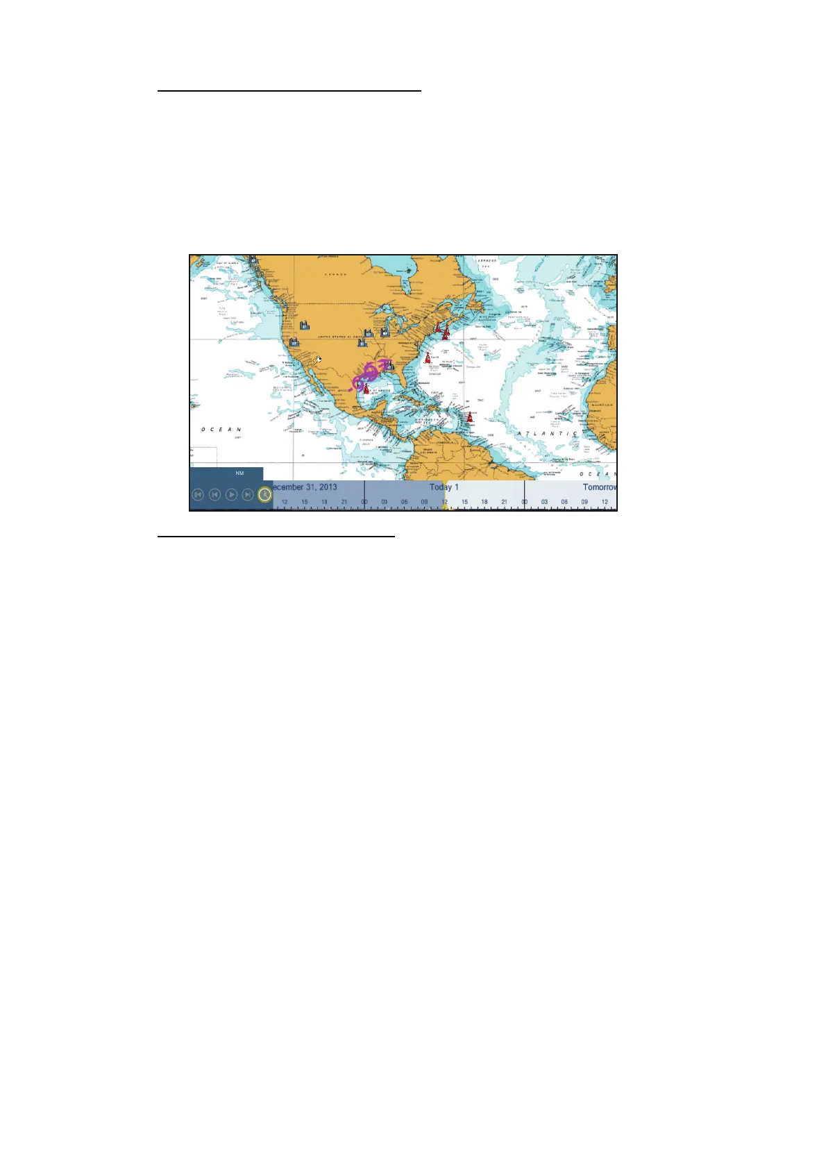
[Adv Wx Data] (Advanced weather)
The advanced weather display provides the weather data; [Buoys], [City], [Storm],
[Lighting] or [Storm Tracks] or [Marine Zone]. For the icons of these data, see
section 13.4.
1. Tap the screen to show the pop-up menu, then tap [Adv Wx Data].
2. Tap a menu item to display its data.
3. Repeat steps 1 and 2 to select all menu items desired.
[Anim Radar] (Animation radar)
The animation radar display provides the past weather radar information. To show the
animation radar display, tap [Anim Radar] on the pop-up menu. To stop the animation
display, tap [End Anim] at the top right-hand corner of the screen.
6,695

Table of Contents

Other manuals for Furuno NAVnet TZtouch2

Questions and Answers:

Question and Answer IconNeed help?

Do you have a question about the Furuno NAVnet TZtouch2 and is the answer not in the manual?

Furuno NAVnet TZtouch2 Specifications

General IconGeneral
Display Size12.1 inches
Resolution1280 x 800 pixels
TouchscreenYes
Brightness1000 cd/m²
Operating Temperature-15°C to 55°C
PortsNMEA 2000, NMEA 0183
Display TypeColor LCD
Power Supply12-24 VDC
GPSBuilt-in

Related product manuals