EasyManuals Logo

Garmin G1000 Guide

Garmin G1000
724 pages
To Next Page IconTo Next Page
To Previous Page IconTo Previous Page
Page #100 background imageLoading...
Page #100 background image
Garmin G1000 Pilot’s Guide for the Socata TBM 850/900
190-00709-05 Rev. D
86
FLIGHT INSTRUMENTS
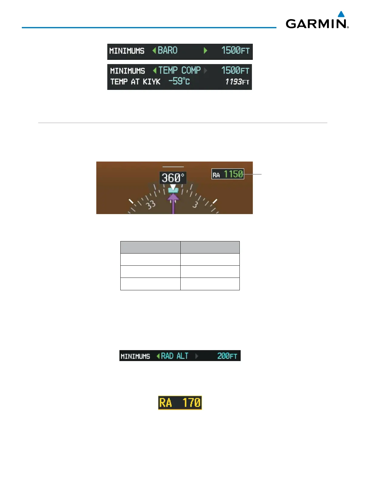
Figure 2-45 BARO and TEMP COMP MDA/DH
RADAR ALTIMETER
When the radar height (the aircraft altitude above ground level detected by the radar altimeter) is between
zero and 2500 feet, the current value is displayed in green to the upper right of the HSI (Figure 2-46). Display
of radar height becomes more sensitive as the height above ground decreases (Table 2-3).
Figure 2-46 Current Radar Height
Radar Altimeter
Radar Height Range Shown to Nearest
0 to 200 feet 5 feet
200 to 1500 feet 10 feet
1500 to 2500 feet 50 feet
Table 2-3 Radar Altimeter Sensitivity
When the radar altimeter is selected as the altitude source for the minimum descent altitude alerting function
(Figure 2-47), the color of the radar height changes to yellow upon reaching (or descending below) the altitude
entered. (Figure 2-48).
Figure 2-47 RAD ALT Setting
(Timer/References Window)
Figure 2-48 RA as Altitude Source for MDA/DH

Table of Contents

Other manuals for Garmin G1000

Questions and Answers:

Question and Answer IconNeed help?

Do you have a question about the Garmin G1000 and is the answer not in the manual?

Garmin G1000 Specifications

General IconGeneral
Display TypeLCD
Primary Flight Display (PFD)Yes
Multi-Function Display (MFD)Yes
Terrain AwarenessYes
Autopilot IntegrationYes
Integrated Flight Deck SystemYes
Weather RadarOptional
Traffic Advisory System (TAS)Optional
Terrain Awareness and Warning System (TAWS)Yes
Resolution1024 x 768 pixels
Weather DataYes
NavigationYes
AHRSYes
Air Data Computer (ADC)Yes
InterfacesARINC 429, RS-232
CertificationTSO certified
Traffic InformationOptional (requires ADS-B or TCAS)

Related product manuals