190-00709-05 Rev. D
Garmin G1000 Pilot’s Guide for the Socata TBM 850/900
681
APPENDIX B
GARMIN DATABASES
The following databases are stored on Supplemental Data Cards provided by Garmin:
• Expanded basemap
• Terrain
• Airport terrain
• Obstacle
• SafeTaxi
• FliteCharts
• Airport Directory
(AOPA)
After subscribing to the desired database product, these database products will be downloaded and ultimately
stored on three Supplemental Data Cards (with the exception of FliteCharts, which is loaded on only one card).
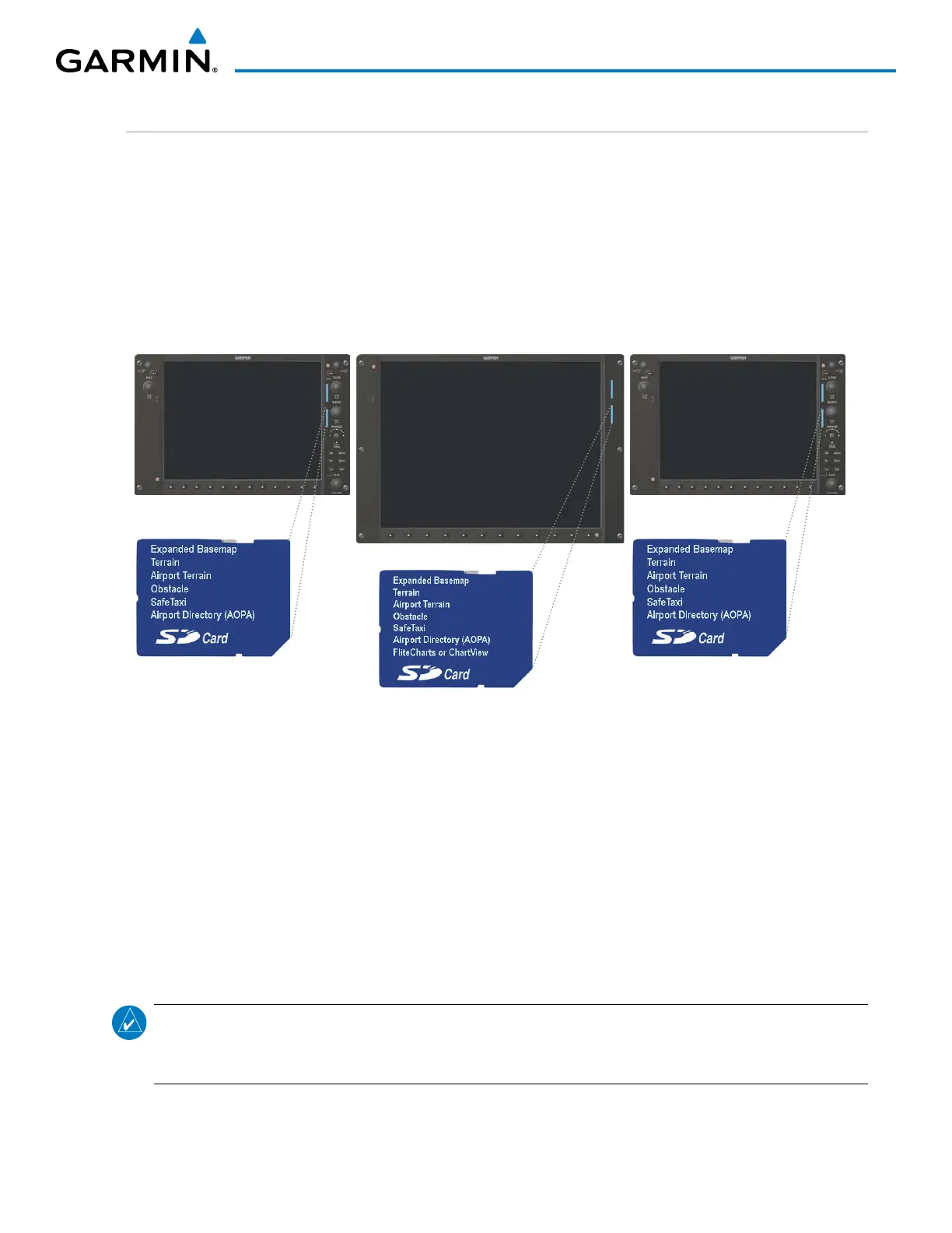
Each Supplemental Data Card resides in the bottom card of each display as shown in Figure B-7. These cards
must not be removed except to update the databases stored on each card.
Figure B-7 Correct Database Locations
MFD
PFD1
PFD2
Since these databases are not stored internally in the displays, a Supplemental Data Card containing identical
database versions must be kept in each display unit.
The basemap database contains data for the topography and land features, such as rivers, lakes, and towns.
It is updated only periodically, with no set schedule. There is no expiration date.
The terrain database contains the terrain mapping data. The airport terrain database contains increased
resolution terrain data around airports. These databases are updated periodically and have no expiration date.
The obstacle database contains data for obstacles, such as towers, that pose a potential hazard to aircraft.
Obstacles 200 feet and higher are included in the obstacle database. It is very important to note that not all
obstacles are necessarily charted and therefore may not be contained in the obstacle database. This database is
updated on a 56-day cycle.
NOTE: The data contained in the terrain and obstacle databases comes from government agencies. Garmin
accurately processes and cross-validates the data, but cannot guarantee the accuracy and completeness of
the data.
The AOPA Airport Directory provides data on airports and heliports throughout the U.S., and offers detailed
information for over 5,300 U. S. airports, along with the names and phone numbers of thousands of FBOs. This
database is updated four times per year.

 Loading...


