190-00709-05 Rev. D
Garmin G1000 Pilot’s Guide for the Socata TBM 850/900
539
AUTOMATIC FLIGHT CONTROL SYSTEM
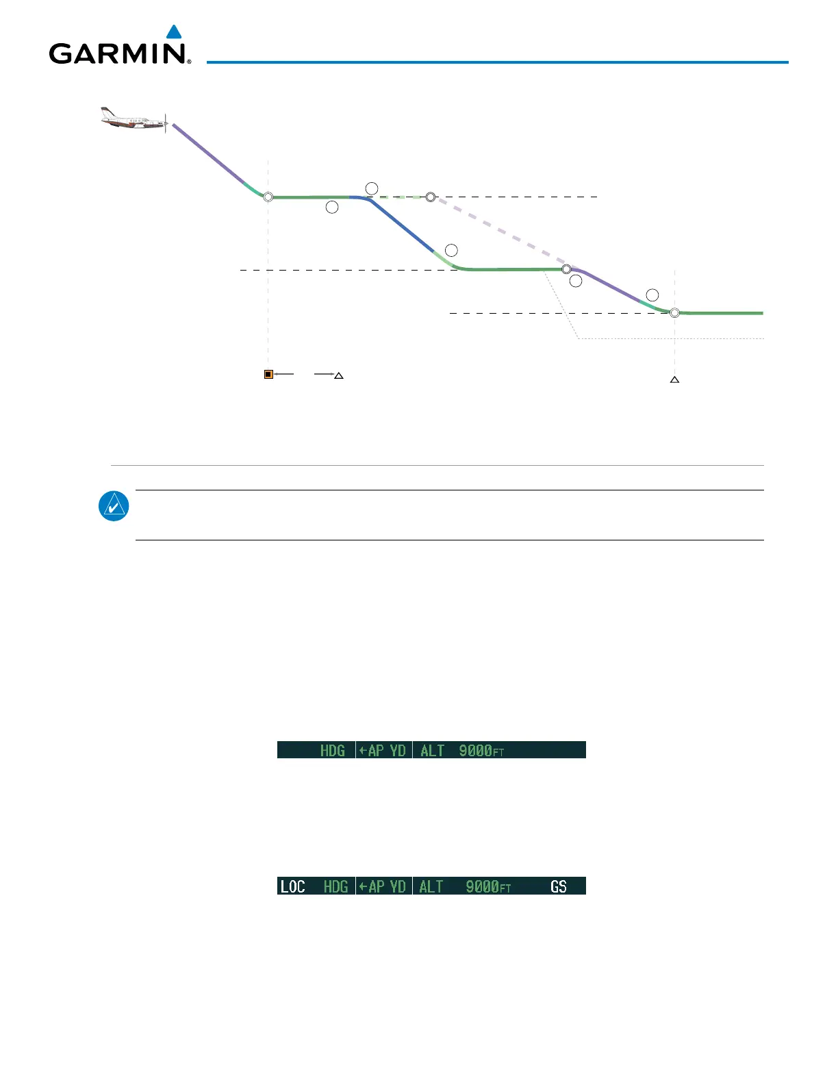
Figure 7-41 Non-path Descent
OPSHN
3 nm
HABUK
VNAV Target Altitude of 10,000 MSL
VNAV Target Altitude of 9,000 MSL
ALT Mode
Planned Descent Path
Selected Altitude of 9,400 MSL
ALT Mode
VPTH Mode
1
2
3
FLC Mode
4
VPTH Mode
ALT Mode
Selected Altitude
5
TOD
Planned
TOD
BOD
BOD
APPROACH
NOTE: If an approach contains a DME arc, the arc must be flown in Navigation Mode with the AFCS. When
receiving vectors from ATC, Navigation Mode must be selected prior to intercepting the ARC.
Flying an ILS approach:
1) Transition from GPS Navigation Mode to Heading Select Mode.
a) Select the Runway 35L ILS approach for KCOS and select ‘VECTORS’ for the transition. Load and activate the
approach into the flight plan.
b) Use the HDG Knob to set the Selected Heading after getting vectors from ATC.
c) Press the HDG Key. The autopilot turns the aircraft to the desired heading.
d) Use Heading Select Mode to comply with ATC vectors as requested.
2) Arm LOC Approach and Glideslope modes.
a) Ensure the appropriate localizer frequency is tuned.
b) Press the APR Key when cleared for approach to arm Approach and Glideslope modes. ‘LOC’ and ‘GS’ appear
in white as armed mode annunciations.
c)
The navigation source automatically switches to LOC. After this switch occurs, the localizer signal can be captured
and the autopilot and flight director determine when to begin the turn to intercept the final approach course. The
flight director now provides guidance to the missed approach point.

 Loading...


