Garmin G1000 Pilot’s Guide for the Socata TBM 850/900
190-00709-05 Rev. D
538
AUTOMATIC FLIGHT CONTROL SYSTEM
Non-path descent using Flight Level Change Mode:
1) Command a non-path descent to an intermediate altitude above the next VNV flight plan altitude. Use Flight
Level Change Mode:
a) Using the ALT SEL Knob, set the Selected Altitude below the current aircraft altitude to an altitude (in this case,
9,400 feet) at which to level off between VNV flight plan altitudes.
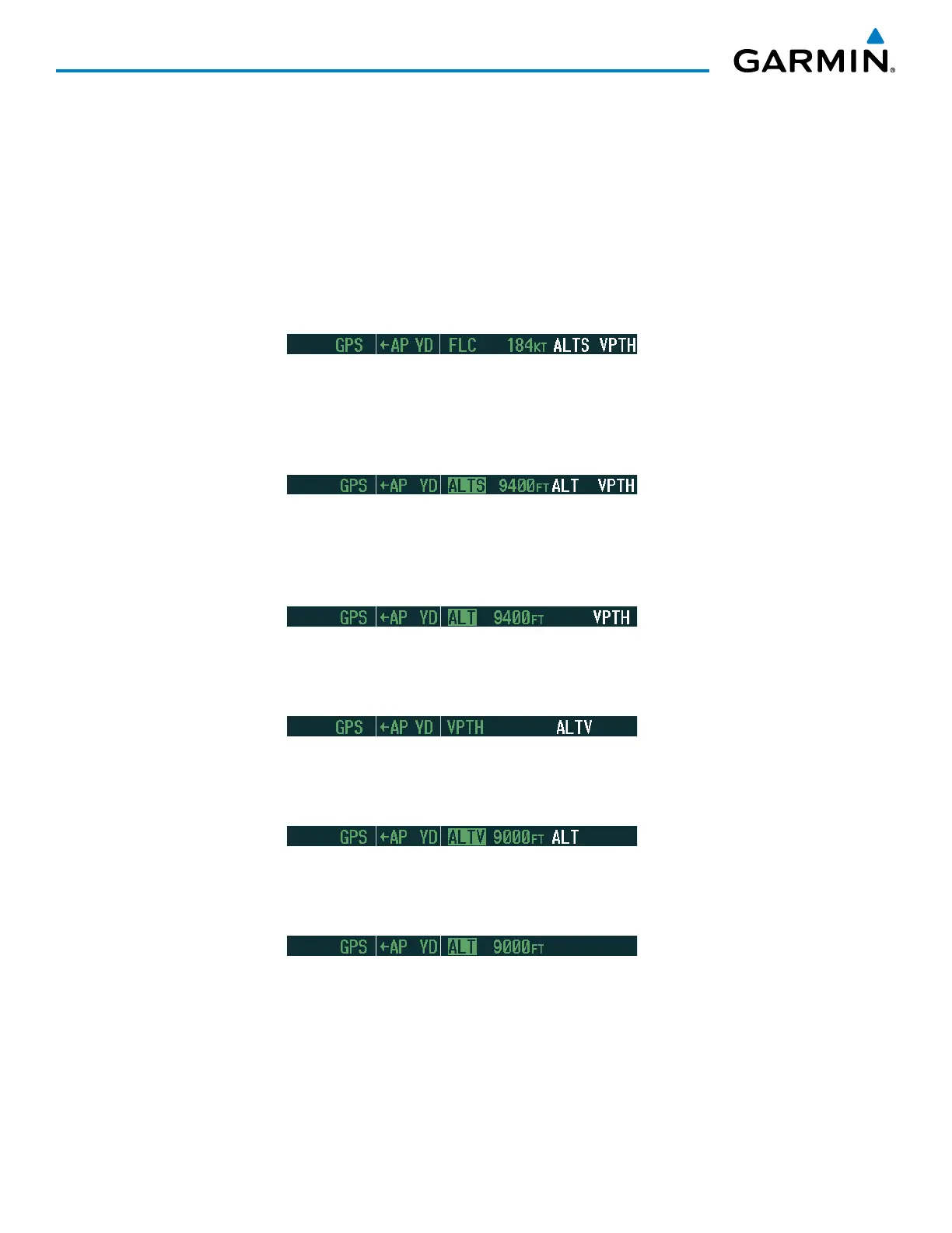
b) Press the FLC Key before the planned TOD during an altitude hold while VPTH is armed. The Airspeed Reference
defaults to the current aircraft airspeed. Vertical Path Tracking and Selected Altitude Capture Mode are armed
automatically.
2) Reduce power to allow descent in Flight Level Change Mode. The autopilot maintains the Airspeed Reference.
3) As the aircraft nears the Selected Altitude, the flight director transitions to Selected Altitude Capture Mode,
indicated by the green ‘ALTS’ annunciation flashing for up to 10 seconds.
The green ‘ALT’ annunciation flashes for up to 10 seconds upon reaching 50 feet from the Selected Altitude; the
autopilot transitions to Altitude Hold Mode and levels the aircraft. After leveling off, reset the Selected Altitude
at or below 9000 ft.
4) When the next TOD is reached, Vertical Path Tracking becomes active (may require acknowledgment to allow
descent path capture).
5) As the aircraft nears the VNV Target Altitude, the flight director transitions to VNV Target Altitude Capture Mode,
indicated by the green ‘ALTV’ annunciation flashing for up to 10 seconds.
The green ‘ALT’ annunciation flashes for up to 10 seconds upon reaching 50 feet from the VNV Target Altitude;
the autopilot transitions to Altitude Hold Mode and levels the aircraft at the vertical waypoint.

 Loading...


