Garmin G1000 Pilot’s Guide for the Socata TBM 850/900
190-00709-05 Rev. D256
FLIGHT MANAGEMENT
PARALLEL TRACK
The Parallel Track (PTK) feature allows creation of a parallel course offset of 1 to 50 nm left or right of the
current flight plan. When Parallel Track is activated, the course line drawn on the map pages shows the parallel
course, and waypoint names have a lower case “p” placed after the identifier.
Using direct-to, loading an approach, a holding pattern, or editing and activating the flight plan automatically
cancels Parallel Track. Parallel Track is also cancelled if a course change occurs greater than 120° or the parallel
tracks overlap as a result of the course change.
NOTE: Vertical navigation is unavailable while the Parallel Track feature is active.
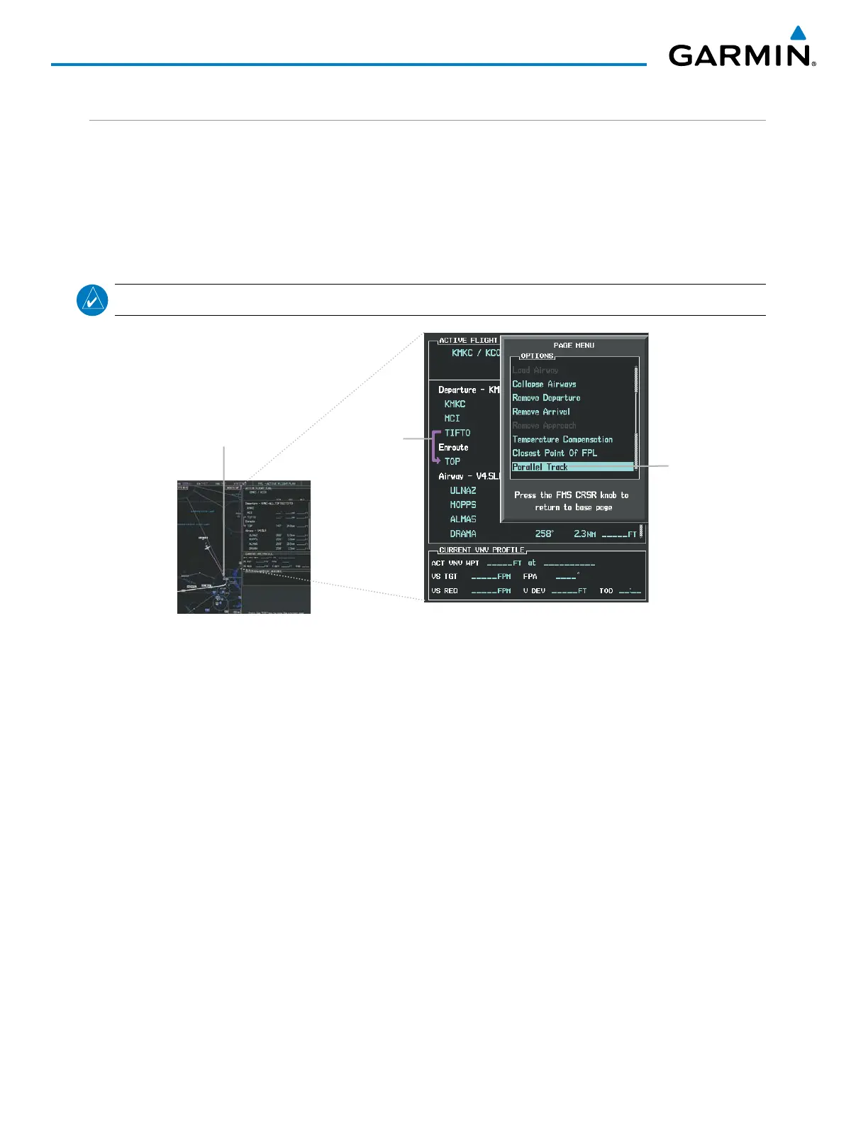
Figure 5-79 Active Flight Plan Window - Selecting Parallel Track
Active Flight Plan prior to Parallel Track
Selecting Parallel
Track
Activating parallel track:
1) Press the FPL Key to display the Active Flight Plan Page (MFD) or the Active Flight Plan Window (PFD)
2) Press the MENU Key, highlight ‘Parallel Track’, and press the ENT Key. The Parallel Track Window is displayed
with the direction field highlighted.
3) Turn the small FMS Knob to select ‘Left’ or ‘Right’ and press the ENT Key. The ‘DISTANCE’ field is highlighted.
4) Turn the small FMS Knob to enter a distance from 1-99 nm and press the ENT Key. ‘ACTIVATE PARALLEL
TRACK’ is highlighted.
5) Press the ENT Key to activate parallel track. Press the FMS Knob or the CLR Key to cancel the parallel track
activation.

 Loading...


