190-00709-05 Rev. D
Garmin G1000 Pilot’s Guide for the Socata TBM 850/900
463
HAZARD AVOIDANCE
6.8 PROFILE VIEW TERRAIN
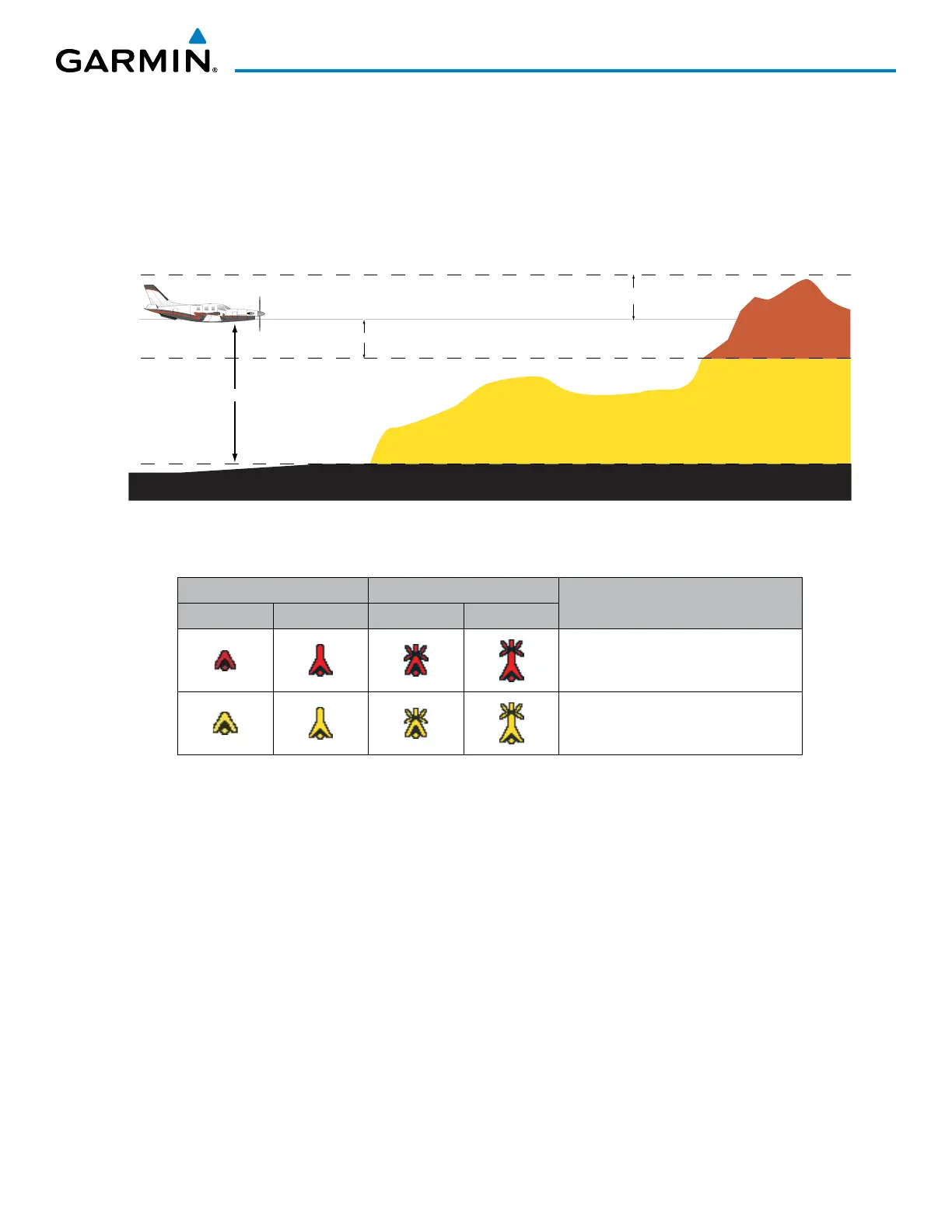
The G1000 offers a Profile View of terrain and obstacles relative to the aircraft’s current flight path and altitude
on the Navigation Map Page of the MFD. Profile View does not provide terrain or obstacle caution or warning
annunciations or voice alerts systems, nor does it display potential impact points inside the Profile View. The
colors and symbols in Figure 6-158 and Table 6-25 are used to represent terrain and obstacles.
1000 ft
Aircraft Altitude
100 ft Threshold
Terrain Above Aircraft Altitude
Red terrain is above
or within 100 ft below
the aircraft altitude
Yellow terrain is between 100 ft and 1000 ft below the aircraft altitude
Black terrain is more than 1000 ft below the aircraft altitude
Figure 6-158 Terrain Altitude/Color Correlation for Profile View Terrain
Unlighted Obstacle Lighted Obstacle
Obstacle Location
< 1000’ AGL > 1000’ AGL < 1000’ AGL > 1000’ AGL
Red obstacle is above or within 100 ft
below the aircraft altitude
Yellow obstacle is between 100 ft and
1000 ft below the aircraft altitude
Table 6-25 Profile View Terrain/Obstacle Colors and Symbology
Enabling/Disabling Profile View:
1) Select the Navigation Map Page.
2) Press the MAP Softkey.
3) Press the PROFILE Softkey to enable or disable Profile View.
Or:
1) Press the MENU Key.
2) Select ‘Show Profile View’ or ‘Hide Profile View’ (choice dependent on current state) and press the ENT Key.
Enabling/Disabling Profile View Terrain on the Navigation Map (when Profile View is enabled):
1) Select the Navigation Map Page.
2) Press the MAP Softkey.
3) Press the TERRAIN Softkey.

 Loading...


