190-00709-05 Rev. D
Garmin G1000 Pilot’s Guide for the Socata TBM 850/900
69
FLIGHT INSTRUMENTS
COURSE DEVIATION INDICATOR (CDI)
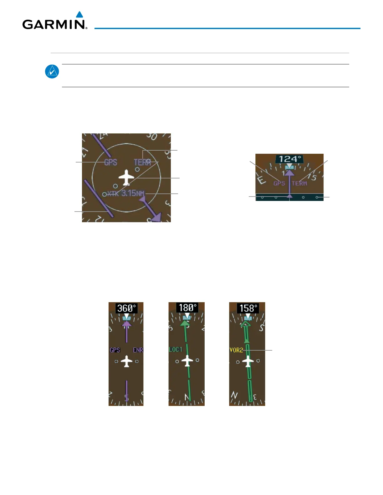
NOTE: During a heading change of greater than 105° with respect to the course, the CDI on the Arc HSI
switches to the opposite side of the deviation scale and displays reverse sensing.
The Course Deviation Indicator (CDI) moves left or right from the course pointer along a lateral deviation
scale to display aircraft position relative to the course. If the course deviation data is not valid, the CDI is not
displayed.
Figure 2-23 Course Deviation Indicator
Flight
Phase
Scale
Crosstrack
Error
Navigation
Source
CDI
360° HSI
Navigation
Source
Flight
Phase
CDI
Scale
CDI
Arc HSI
The CDI can display two sources of navigation: GPS or NAV (VOR/LOC). The color indicates the current
navigation source: magenta for GPS or green for VOR and LOC. The full scale limits for the CDI are defined
by a GPS-derived distance when navigating GPS. When navigating using a VOR or localizer (LOC), the CDI
has the same angular limits as a mechanical CDI. If the CDI exceeds the maximum deviation on the scale (two
dots) while navigating with GPS, the crosstrack error (XTK) is displayed below the white aircraft symbol.
Navigation
Source Selected
on Both PFDs
Figure 2-24 Navigation Sources

 Loading...


