Garmin G1000 Pilot’s Guide for the Socata TBM 850/900
190-00709-05 Rev. D464
HAZARD AVOIDANCE
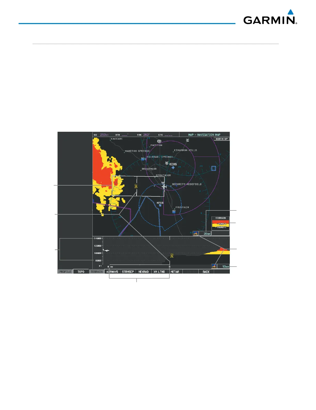
PROFILE VIEW DISPLAY
When the Profile View is enabled, it is displayed in a window below the Navigation Map. Altitude is shown
along a vertical scale, with an aircraft icon positioned at the current altitude. Distance is represented horizontally
along the bottom of the Profile View, and increases from left (present position) to right.
When the Navigation Map range is adjusted with the RANGE Knob, the horizontal distance of the Profile
View is adjusted proportionately to be 1/2 of the Navigation Map range distance down to 1 nm, at which point
Profile View is no longer available (‘PROFILE NOT AVAILABLE’ is displayed). When Navigation Map range
is adjusted to remove altitude-correlated colored terrain data (as shown in the Terrain Legend) or obstacles
from the Navigation Map, these items are also removed from the Profile View; only an outline of the terrain
will be displayed in black in the Profile View window. Refer to the Terrain Proximity, Terrain-SVS, or TAWS-B
discussions for more information about displaying terrain or obstacles on the Navigation Map Page.
Terrain Legend
Profile View Length
is One Half of the
Navigation Map
Range
Figure 6-159 Profile View on Navigation Map with Terrain Display Enabled
Altitude Scale
Distance Scale
Terrain Enabled Icons
Navigation Map Range
Profile Path
Range
Markers
The Profile View is based on the current aircraft track (or heading if track is unavailable) and shows the highest
known terrain or obstacles within a predetermined width from the present aircraft position to the end of the
profile range. The width of the Profile View is determined by the phase of flight, as annunciated on the HSI,
and is widest during enroute and oceanic phases (Table 6-26).

 Loading...


