190-00709-05 Rev. D
Garmin G1000 Pilot’s Guide for the Socata TBM 850/900
533
AUTOMATIC FLIGHT CONTROL SYSTEM
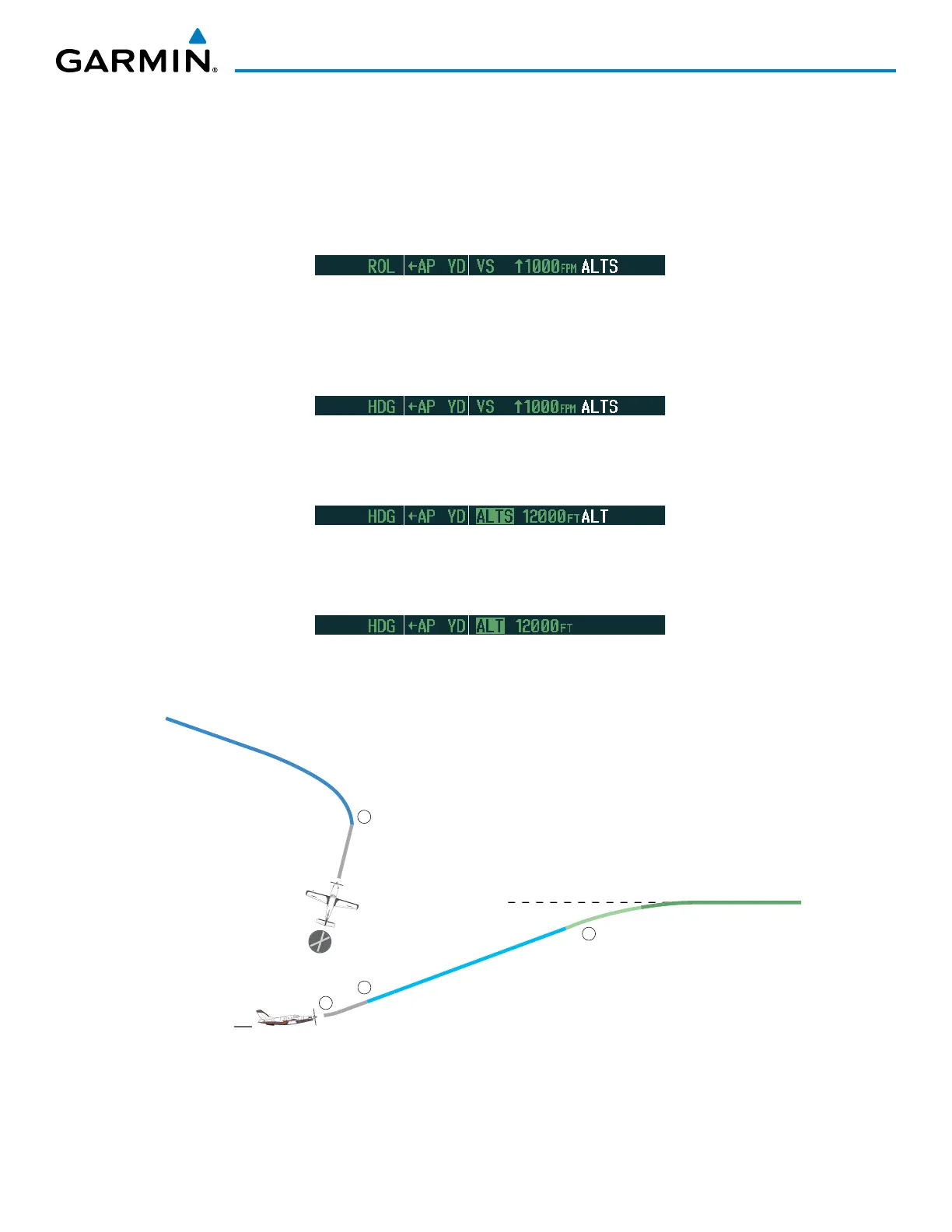
2) In this example, Vertical Speed Mode is used to capture the Selected Altitude (Pitch Hold, Vertical Speed, or
Flight Level Change Mode may be used).
a) Press the VS Key to activate Vertical Speed Mode.
The Vertical Speed Reference may be adjusted after Vertical Speed Mode is selected using the NOSE UP/DN
Wheel or pushing the CWS Button while hand-flying the aircraft to establish a new Vertical Speed Reference.
3) Use the
HDG
Knob to set the Selected Heading, complying with ATC vectors to intercept Airway V4.
Press the HDG Key to activate Heading Select Mode while the autopilot is engaged in the climb. The autopilot
follows the Selected Heading Bug on the HSI and turns the aircraft to the desired heading.
4) As the aircraft nears the Selected Altitude, the flight director transitions to Selected Altitude Capture Mode,
indicated by the green ‘ALTS’ annunciation flashing for up to 10 seconds.
At 50 feet from the Selected Altitude, the green ‘ALT’ annunciation flashes for up to 10 seconds; the autopilot
transitions to Altitude Hold Mode and levels the aircraft.
Figure 7-36 Departure
Selected Altitude of 12,000 MSL
1
2
3
4
HDG Mode
VS Mode
ALT Mode
TO Mode
TO Mode
KMKC

 Loading...


