Section 4 Operation
56
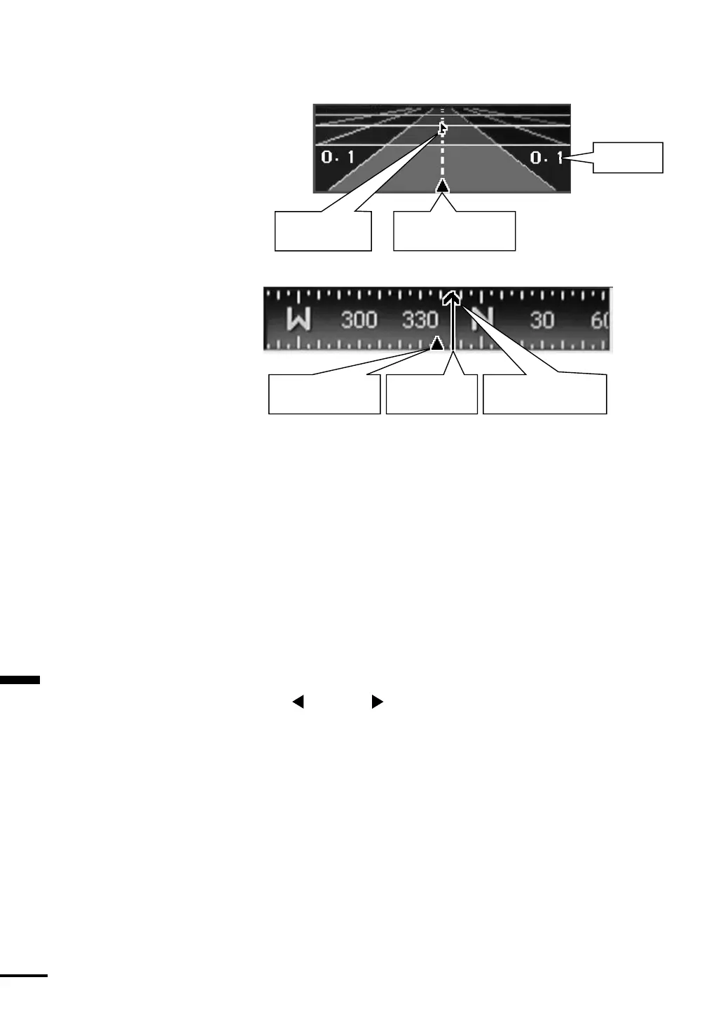
Waypoint marker
Vessel position marker
(devition from course)
CDI range
Vessel course marker
Bearing marker Vesser heading marker
Navigation mode displays data
[Highway window]
[Compass window]
[Numeric Data]
DEP: Depth
SPD: Vessel speed (unit: KT=knots, KH=km/hour, MH=mile/hour)
RTE: Selected Route plan number
WPT: Waypoint ID
COG: Vessel Coures over ground (unit: degree/ T=true, M=magnetic)
BRG: Bearing to destination (unit: degree/ T=true, M=magnetic)
HDG:Vessel heading (unit: degree/ T=true, M=magnetic)
RNG: Distance to go dest destination (unit: 0.1 NM)
XTE: Closs track error. Deviation from course and direction to steer
(unit: 0.01 NM)
Steering required to return to the planned course is indicated
(Left) and (Right).
Note:
To display the vessel heading marker and HDG (Vessel heading), it is
necessary to receive the vessel heading data in the NMEA0183 standard
format. You need to connect the specified signal line to the NMEA
connector on the rear panel to receive the vessel heading data. Refer to
Section 3-5 for information about connection. After connection, be
sure to check that the NMEA0183 sentences of $xxHDG, $xxHDT or
$xxHDM are output. (You can check this easily using the selftest mode
of the FF50.)