Section 6 Principal
91
GPS/DGPS Basics
GPS
The Navstar/GPS system is a satellite-based radio navigation system designed
to provide global, continuous 24 hour-per-day, all weather, accurate position data
for navigators. The GPS(Global Positioning System) is based on a GPS sensor’s
ability to accurately measure the propagation time of signals transmitted from
orbiting satellites in your sensor.
The satellites transmit accurately timed signals along with a navigation
message which includes the satellite’s position (orbit or ephemeris data), precise
time (clock) correction signals, and almanac data for the complete constellation of
satellites.
GPS System
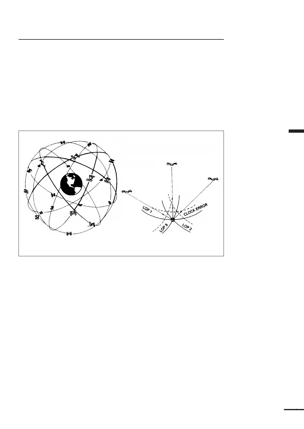
Figure 6-3
The complete constellation will consist of 24 satellites (3 spare satellites) in 6
orbital planes. Four satellites are equally spaced in each plane.
The four satellites equally spaced in each plane circle the globe once every 12
hours at a distance of approximately 20,000Km from the Earth.
The satellites continuously broadcast their navigation messages at a frequency
of 1575.42MHz (for civilian use). The message is repeated every 30 seconds.
Superimposed on the navigation message is a high rate C/A (coarse/acquisition)
code used for precise positioning measurements and positive satellite
identification. The C/A ID code permits the user to determine and select the
“best satellites” to use in position calculations.
If it were possible to measure “true satellite ranges” directly, it would only be
necessary to track data from any two satellites to obtain a vessel’s latitude/
longitude. In actual practice, for marine navigation, a minimum of three satellites
are normally tracked in order to reduce the sensor’s own internal clock timing bias
error.
By calculating the ranges of four satellites, the clock timing bias error can be
eliminated and the vessel’s three dimensional position can be determined.