GOTO ·aDestination
You
can use your eXplorist receiver
to
go
to ("GOTO") any
destination
in
your
POI
database. This can
be
one of the
pal's
that
was
preloaded in your eXplorist receiver, a geocaching
point or a
POI
that
you
have saved. Once a
GOTO
route
has
been defined, your eXplorist receiver will guide you
in
a straight
line to your destination.
If
you
need to move away from the
suggested path, the eXplorist receiver will continuously update
the route, keeping
you
headed towards your destination.
Setting a GOTO Route
From any screen, press
__
Goro.
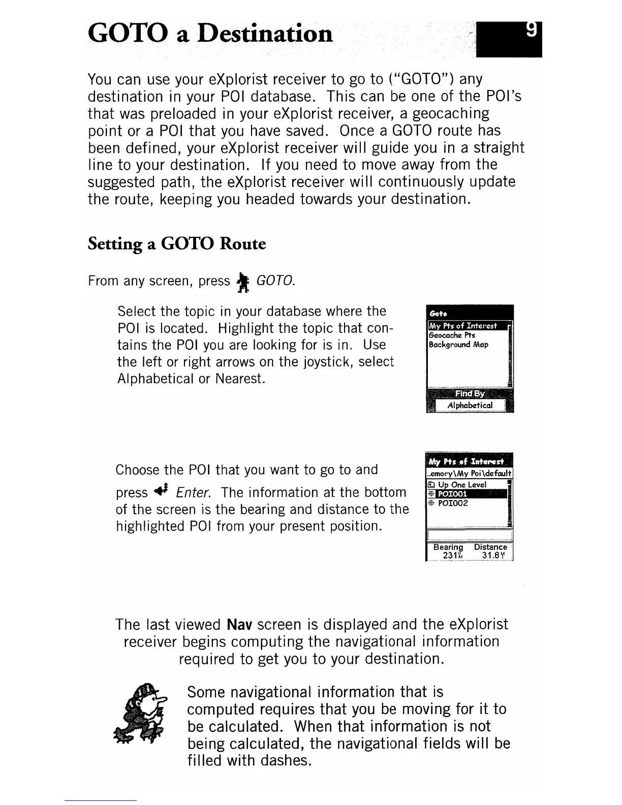
Select the
topic
in your database where the
POI
is located.
Highlight
the
topic
that
con-
tains
the
POI
you are looking for is in. Use
the
left
or right arrows
on
the
joystick, select
Alphabetical or Nearest.
Choose the
POI
that
you want
to
go
to
and
press
..
Enter. The information at
the
bottom
of
the
screen is
the
bearing and distance
to
the
highlighted
POI
from your present position.
..
emol·y\My Poi\default
ItJ
Up
One
Level
:$.g.)(ej
••
1$-
POI002
The last viewed
Nav
screen
is
displayed and the eXplorist
receiver begins computing the navigational information
required to get you to your destination.
Some navigational information
that
is
computed requires
that
you
be
moving for
it
to
be
calculated. When
that
information is not
being calculated, the navigational fields will
be
fi lied with dashes.