2D chart view
The 2D chart view displays a range of information to help you
navigate.
Item Description
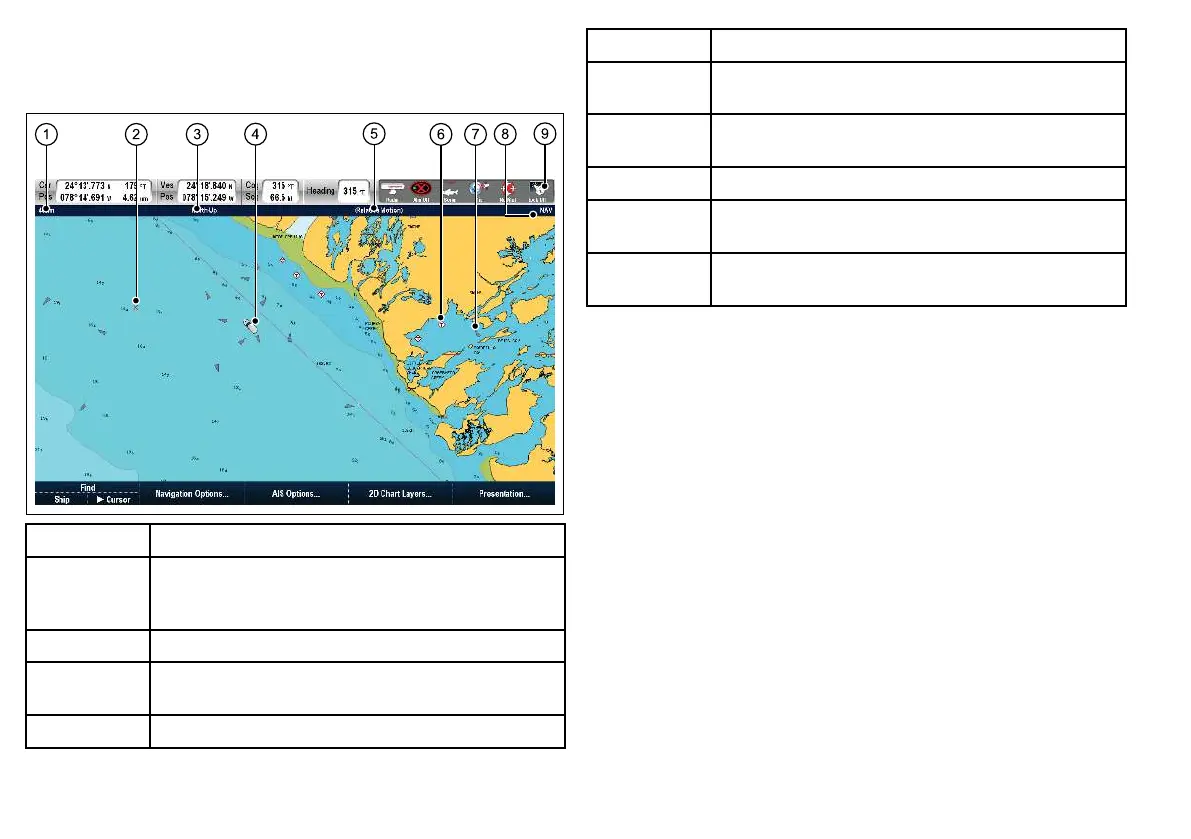
1
Range — horizontal distance across screen (halfway up the
window or at center-of-view). Shown in selected system
units.
2 Waypoint — with arrival circle.
3
Orientation — states the orientation mode that the chart is
using (North-up, Head-up, or Course-up).
4 Vessel symbol— shows your current position.
Item Description
5
Motion mode — states the current motion mode (Relative,
True, or Autorange).
6
Cartographic objects — use the Cartography Setup menu
to choose which objects to display.
7
AIS target — a vessel broadcasting AIS information.
8
Chart type — indicates the type of chart in use — Fish or
Navigation.
9
Status bar — displays the status of externally connected
equipment.
76 E-Series Widescreen User reference

 Loading...


