2. Use the SYNC softkey to select the CHRT option.
3. If you have networked displays, repeat Step 2 in the chart
application on each display that you want to synchronize.
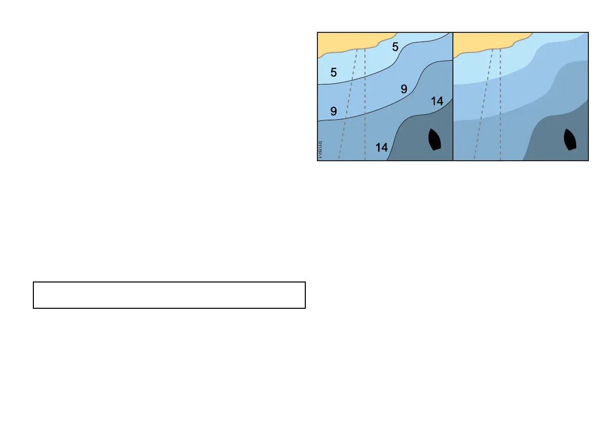
Fish mode
Fish mode provides bathymetric contour data on the chart for use
during shing.
Before you can display bathymetric data in the chart application you
must have chart cards with the relevant level of detail.
When you change the CHART TYPE to the FISH option, bathymetric
data is shown on the chart (providing that the chart card contains
bathymetric data for that particular location). Certain chart detail is
also removed to ensure the bathymetric data can be seen clearly
on the chart display.
If the chart card does NOT contain bathymetric data the chart
reverts to the default NAV (navigation) data.
Enabling Fish mode
In the chart application:
1. Select the PRESENTATION softkey.
2. Select the CHART TYPE softkey .
3. Use the CHART USE softkey to select the FISH option.
Note: The CHART USE softkey is disabled if your cartography
does NOT support the feature.
Chart Detail
The chart detail setting determines the amount of cartographic detail
shown in the chart application.
Selecting the LOW option for the CHART DETAIL softkey hides the
following cartographic objects:
• Text.
• Chart boundaries.
• Spot soundings.
• Depth contours.
• Light sectors.
• Caution and routing Data.
• Land and marine features.
• Business services (if available for your chart card).
Selecting the HIGH option shows these objects.
Changing the level of chart detail
In the chart application:
1. Select the PRESENTATION softkey.
Using the chart
91

 Loading...


