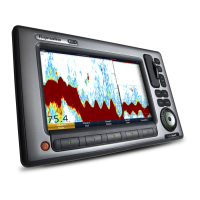
Cartography setup menu options
The following table describes the various options in the Cartography Setup Menu for your multifunction display.
Menu item Description Options
Chart Display Determines the level of detail shown on the chart. • Simple
• Detailed (default)
• Extra Detailed
Chart Grid
Determines whether grid lines representing longitude and latitude are
displayed on the chart:
• OFF — grid lines are NOT displayed.
• ON — grid lines are displayed.
• OFF
• ON (default)
Chart Text Determines whether chart text is displayed (place names and so on).
• OFF — chart text is NOT displayed.
• ON — chart text is displayed.
• OFF
• ON (default)
Chart Boundaries
Determines whether a line indicating the chart boundary is displayed.
• OFF — chart boundary is NOT displayed.
• ON — chart boundary is displayed.
• OFF
• ON (default)
Spot Soundings
Determines whether a number indicating depth is displayed.
• OFF — depth is NOT displayed.
• ON — depth is displayed.
• OFF
• ON (default)
Using the chart
99

 Loading...


