22
RayChart 620 and 630
Controlling
the Chart
indicate that the chartplotter is in Plotter Mode.
The chart detail is restored when you return to a chart scale for which the
information is available.
➤ To zoom out to a smaller scale chart, simply press the upper part of the RANGE
key as many times as required. If no smaller scale chart is available, then the
chartplotter beeps three times when you press the upper part of the RANGE key.
Changing the Chart Center
You can move a chosen point to the center of the chart, using the CENTER soft
key. The chosen point can be the vessel’s position, the cursor position or a
specified position.
You can also select Home Mode, which centers the vessel, homes the cursor
and changes the cursor data box to provide information about your vessel’s
position. The chart moves to ensure that the vessel remains on-screen.
Note: Changing the range scale always centers the chart on the cursor.
Centering the Chart
➤ To center the chart using the CENTER options:
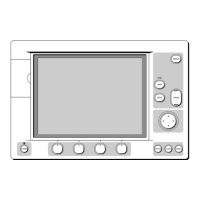
1. From the initial soft key display, press the CENTER soft key.
The following soft keys are displayed:
CENTER BOAT
CENTER CURSOR REMOTE CENTER HOME
D3351_1
2. Press the soft key for the center option you require (or CLEAR to return to
the initial screen):
- CENTER BOAT moves the chart so that your vessel’s position is at the centre
of the chart, and repositions the cursor so that it is over the vessel
- CENTER CURSOR moves the chart so that the point you selected with the
cursor is at the centre of the chart
- REMOTE CENTER displays an input box for you to enter the position for the
new center
- HOME moves the chart so that your vessel’s position is at the centre of the
chart, and enters Home Mode (see below)
3. If you pressed REMOTE CENTER, the input box displays the current cursor
position, as latitude and longitude or TDs depending on your system.
Controlling the
Chart
 Loading...

