0,/4FUNCTION
Press the [PLOT] key with chart in display, to call up an
info window with the following to choose from:
F Cursor must be
active, otherwise it
will be the ship’s
position which is
plotted.
0LOTMARK Plot and save cursor position as a way-
point.
0LOTMARKWITHNAMEETC Plot and save cursor posi-
tion as a waypoint, toggle between LAT/LON, Loran C
and decca lanes, insert a location name, change the
symbol or change the color on the symbol.
0LOTMARKWITHDEPTH Plot and save cursor position
as a waypoint together with depth information.
-AKEROUTE You can quickly make a route by plot-
ting cursor’s position, one after another i.e. place the
cursor on the first position of the route you wish to
make and press [PLOT]. Move the cursor to the next po-
sition and press [PLOT]. Continue in this manner till the
route is complete. In case you make a wrong plot, press
[CLR] to erase the last plotted position.
Save the route with [ENT] or exit the function with
[MENU] to abandon the route.
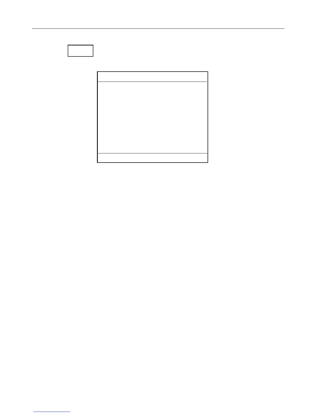
PLOT
Select PLOT mode
0LOTMARK
2:Plot mark with name etc.
3:Plot mark with depth
4:Make route
5:Draw line
6:Plot target
7:Bearing and dist from A to B
8:Dist and TTG in route from A to B
9:Set vertical mark
Exit: MENU
#HAPTER #%-+))#HARTANDPOSITIONMENUS
16