Chart data
The system is delivered with different embedded cartography
depending on region.
All units support Insight charts from Navico including Insight
Genesis. The system also supports Navionics Gold, Platinum+ and
Navionics+, C-MAP MAX-N/MAX-N+ by Jeppesen as well as content
created by variety of third party mapping providers in the AT5
format. For a full selection of available charts please visit
insightstore.navico.com, c-map.jeppesen.com or navionics.com.
Ú
Note: The system does not automatically switch to
embedded cartography if the chart card is removed. A low-
resolution chart will be displayed until you re-insert the
card or manually switch back to the embedded
cartography.
Showing dual chart types
If you have different chart types available - embedded or in the card
slot - you can show two different chart types simultaneously on a
page with two chart panels.
You can select a dual chart panel by pressing and holding the Chart
application button on the Home page, or by creating a favorite
page with two chart panels.
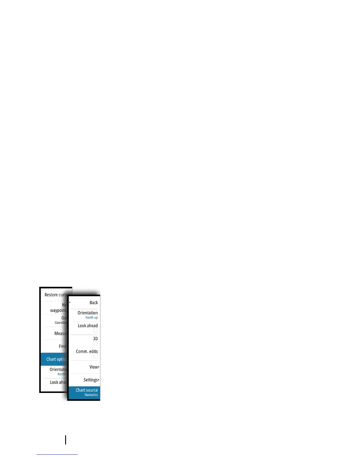
Selecting chart type
You specify the chart type in the Chart panel by selecting one of the
available chart types in the chart source menu option. If you have a
multiple Chart panel, the chart type is set individually for each chart
panel. Activate one of the chart panels, and then select one of the
available chart types in the chart source menu option. Repeat the
process for the second chart panel, and select an alternative chart
type for this panel.
Ú
Note: To show charts other than Navionics, Insight chart
type must be selected.
If you have identical charts available - built in or in the card slot - the
system automatically selects the chart with most chart details for
your displayed region.
28
Charts | GO7 Operator Manual