EasyManuals Logo

Simrad GO7 User Manual

Simrad GO7
122 pages
To Next Page IconTo Next Page
To Previous Page IconTo Previous Page
Page #37 background imageLoading...
Page #37 background image
Ú
Note: All numeric values are shown in the relevant system
units (unit of measurement) set by user.
Easy View
Magnifying feature that increases the size of chart items and text.
Ú
Note: There is no indication on the chart showing that this
feature is active.
Photo overlay
Photo overlay enables you to view satellite photo images of an area
as an overlay on the chart. The availability of such photos is limited
to certain regions, and Navionics cartography version.
You can view photo overlays in either 2D or 3D modes.
No Photo overlay Photo overlay, land only Full Photo overlay
Photo transparency
The Photo transparency sets the opaqueness of the photo overlay.
With minimum transparency settings the chart details are almost
hidden by the photo.
Minimum transparency Maximum transparency
Charts | GO7 Operator Manual
37
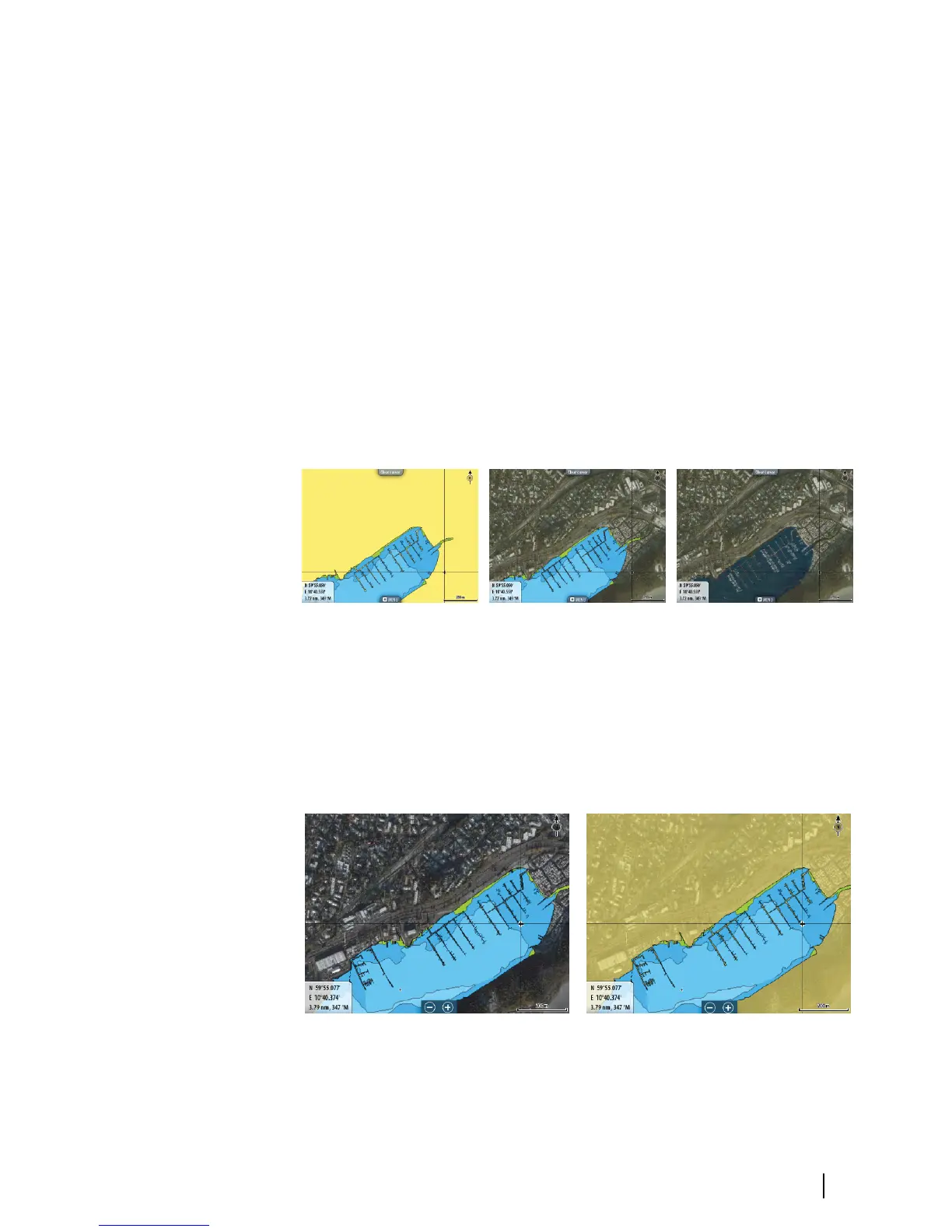
Table of Contents

Other manuals for Simrad GO7

Questions and Answers:

Question and Answer IconNeed help?

Do you have a question about the Simrad GO7 and is the answer not in the manual?

Simrad GO7 Specifications

General IconGeneral
Resolution800 x 480 pixels
TouchscreenYes
NetworkingNMEA 2000
BluetoothYes
ChartplotterYes
Display Size7 inch
GPS TypeInternal
Wireless ConnectivityWi-Fi
Chart CompatibilityC-MAP, Navionics
Display TypeTFT LCD
SD Card Slots1
Sonar CompatibilityCHIRP
Radar CompatibilityYes
Operating Temperature-15°C to 55°C
SonarBroadband, CHIRP, DownScan, SideScan (with compatible transducer)

Related product manuals