EasyManuals Logo

Simrad GO7 User Manual

Simrad GO7
122 pages
To Next Page IconTo Next Page
To Previous Page IconTo Previous Page
Page #34 background imageLoading...
Page #34 background image
Land Exaggeration and Water Exaggeration
Graphical settings available in 3D mode only. Exaggeration is a
multiplier applied to the drawn height of hills on land, and troughs
in water to make them look taller or deeper.
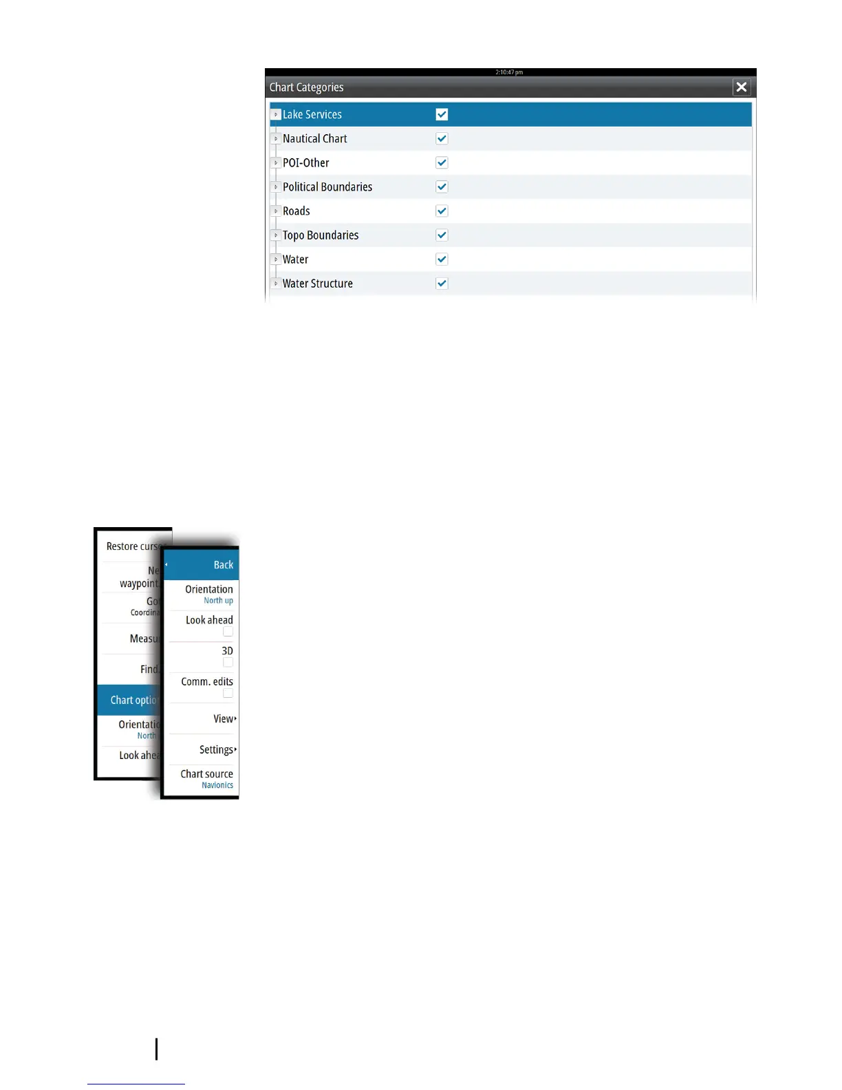
Navionics specific chart options
Orientation, Look ahead, 3D and change Chart source (previously
described in this section) are common for all chart types.
Community edits
Toggles on the chart layer including Navionics edits. These are user
information or edits uploaded to Navionics Community by users,
and made available in Navionics charts.
For more information, refer to Navionics information included with
your chart, or to Navionics website: www.navionics.com.
34
Charts | GO7 Operator Manual

Table of Contents

Other manuals for Simrad GO7

Questions and Answers:

Question and Answer IconNeed help?

Do you have a question about the Simrad GO7 and is the answer not in the manual?

Simrad GO7 Specifications

General IconGeneral
Resolution800 x 480 pixels
TouchscreenYes
NetworkingNMEA 2000
BluetoothYes
ChartplotterYes
Display Size7 inch
GPS TypeInternal
Wireless ConnectivityWi-Fi
Chart CompatibilityC-MAP, Navionics
Display TypeTFT LCD
SD Card Slots1
Sonar CompatibilityCHIRP
Radar CompatibilityYes
Operating Temperature-15°C to 55°C
SonarBroadband, CHIRP, DownScan, SideScan (with compatible transducer)

Related product manuals