EasyManuals Logo

Simrad GO7 User Manual

Simrad GO7
122 pages
To Next Page IconTo Next Page
To Previous Page IconTo Previous Page
Page #33 background imageLoading...
Page #33 background image
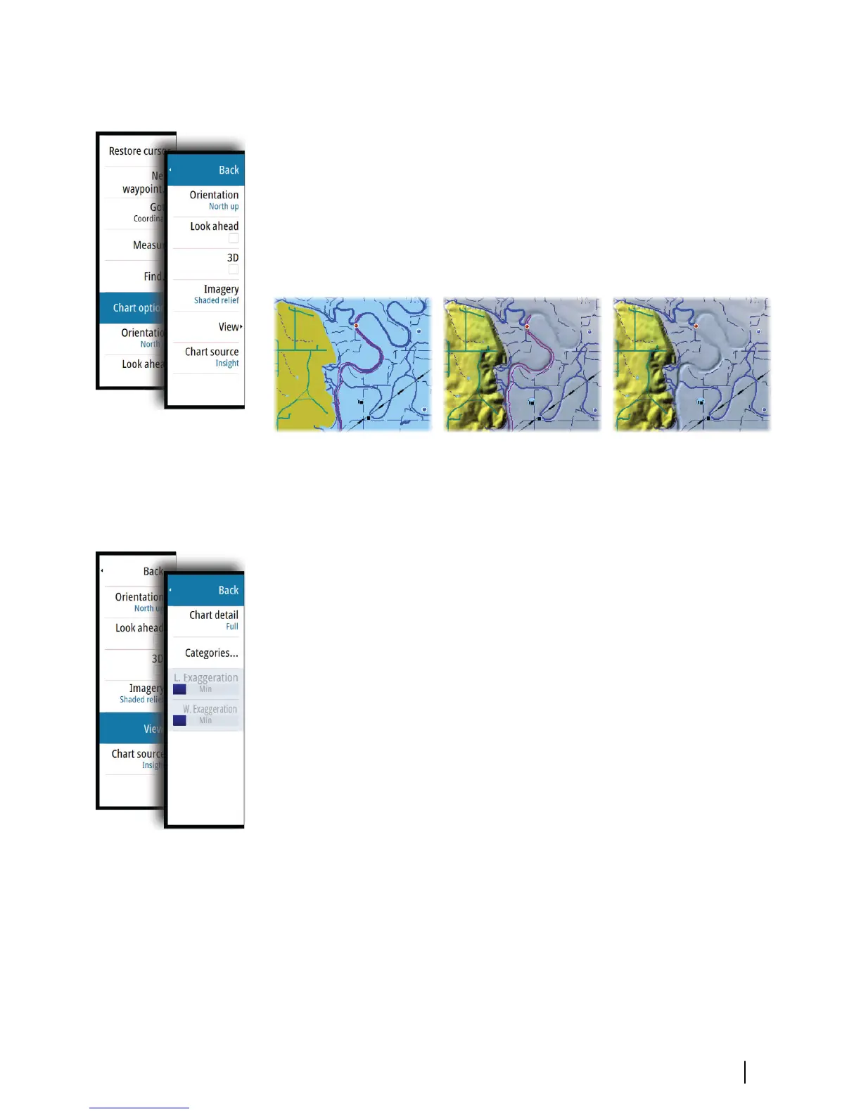
Insight specific chart options
Orientation, Look ahead, 3D, and change Chart source (previously
described in this section) are common for all chart types.
Chart imagery style
The charts can be displayed in three imagery styles.
2D mapping style Shaded relief No contours
Insight view options
Insight Chart details
Low
Basic level of information that cannot be removed, and includes
information that is required in all geographic areas. It is not
intended to be sufficient for safe navigation.
Medium
Minimum information sufficient for navigation.
Full
All available information for the chart in use.
Insight chart categories
Insight charts include several categories and sub-categories that
you can turn on/off individually depending on which information
you want to see.
Charts | GO7 Operator Manual
33

Table of Contents

Other manuals for Simrad GO7

Questions and Answers:

Question and Answer IconNeed help?

Do you have a question about the Simrad GO7 and is the answer not in the manual?

Simrad GO7 Specifications

General IconGeneral
Resolution800 x 480 pixels
TouchscreenYes
NetworkingNMEA 2000
BluetoothYes
ChartplotterYes
Display Size7 inch
GPS TypeInternal
Wireless ConnectivityWi-Fi
Chart CompatibilityC-MAP, Navionics
Display TypeTFT LCD
SD Card Slots1
Sonar CompatibilityCHIRP
Radar CompatibilityYes
Operating Temperature-15°C to 55°C
SonarBroadband, CHIRP, DownScan, SideScan (with compatible transducer)

Related product manuals