Paramount GEM User Guide
15 | P a g e
• What is homing and what does it do?
• What is mount parking?
• How does atmospheric refraction affect mount performance?
• Why is polar alignment so important?
In addition to these basic questions, if you have not controlled a “go to” German equatorial mount with
TheSky Professional, please carefully read the following sections and then use TheSky Professional’s
Telescope Simulator before setting up, connecting to, and operating the Paramount.
Coordinate Systems
The three most common coordinate systems used when working with equatorial mountings are described
below. Making sure you understand the differences between each now can really help troubleshooting
issues in the future.
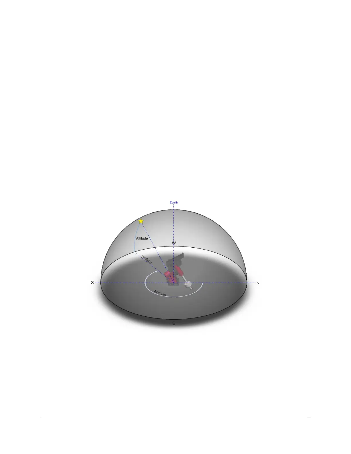
The Horizon Coordinate System
The horizon or “horizontal” coordinate system is used to specify the position of celestial objects relative
to the local horizon.
Figure 1: The horizon coordinate system.
Altitude
The altitude (alt for short) of an object is expressed as the number of degrees from the horizon (the ground
at a far distance) to the object and is always between minus 90 and plus 90 degrees. Objects at an altitude
less than zero are below the horizon. For example, the Sun just after sunrise is close to the horizon so it
has an altitude of a few degrees, and just after sunset its altitude is few degrees negative.