3-8 Interference Mapping Interference Analyzer (Option 25)
3-18 PN: 10580-00349 Rev. H Spectrum Analyzer MG
6. Save the Mapping Information.
Refer to “Save the Mapping Information” on page 3-19.
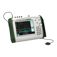
3 Current readings from the MA2700A.
• Compass: Before GPS lock, the compass displays a light gray M indicating
magnetic north (no declination adjustment). With GPS lock, a declination
adjustment is automatically applied based on location and the compass changes to
display a light gray T indicating true north. The Arrow indicates the direction the
MA2700A is pointing.
• Power level: Displays the power level at the Anritsu instrument’s receiver.
• Bearing: Direction the MA2700A is pointing (shown in red).
• Pitch (vertical level): Indicates the front-to-back orientation.
• Roll (horizontal level): Indicates the side-to-side orientation.
4 Current Anritsu instrument settings.
5 GPS lock icon.
6 Current position.
7 Status Icons (left to right). Refer to Figure 6-12 on page 6-18.
• MA2700A USB connection.
• USB memory stick available.
• Map auto-centering mode.
8 Zoom level indication (when using .azm maps). Top is maximum zoomed in position.
Bottom is maximum zoomed out position. Refer to “Pan & Zoom Menu” on page 6-17.
9 Current tile location in base map (when using .azm maps). Move the current tile location
around the base map using the arrow keys on the Anritsu analyzer.
Note: Panning is not functional when the instrument displayed map is at the maximum
zoomed out position.
10 Refer to “Interference Mapping Menu” on page 3-66.
11 Plus sign indicates current position.
12 Previous saved (trigger pull) locations and bearings. Existing bearings can be deleted.
Refer to “Bearing Lines Menu” on page 3-67.
13 Approximate location of the interfering signal.
Figure 3-10. Interference Mapping Overview (2 of 2)
ООО "Техэнком" Контрольно-измерительные приборы и оборудование www.tehencom.com
 Loading...