AeroNav 900/880 Series Pilot’s Guide
89000039-010
Rev 1 May 2019 FMS Subsystem 3-29
COOL FEATURE
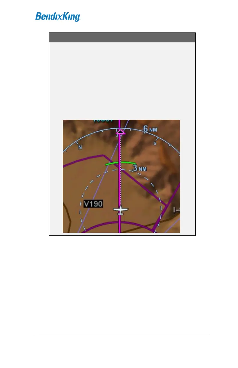
Range to Altitude Indication
A small green arc will be drawn on the map that
depicts the geographic point where, at the current
vertical speed, the aircraft will reach the altitude
target. The altitude target is any crossing restriction
on a waypoint that is either manually entered or a
part of a procedure. It will be removed from the map
when current aircraft altitude is within 150 feet of the
target altitude.