AeroNav 900/880 Series Pilot’s Guide
89000039-010
4-42 Map Subsystem Rev 1 May 2019
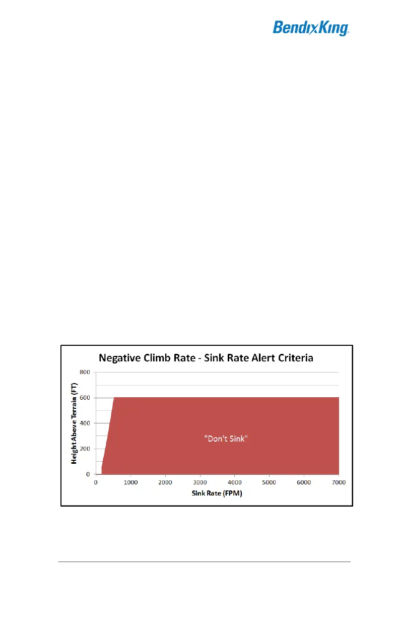
NEGATIVE CLIMB RATE / ALTITUDE LOST AFTER TAKEOFF
The final function of the TAWS system is the alert for a negative
climb rate (NCR) or excessive altitude lost after takeoff/go-around.
Takeoff/Go-around state is defined as a 60 foot climb inside the
FLTA Exclusion area (i.e. “airport environment”) when between 60
and 600 feet AGL.
This function has two algorithms that run whenever the aircraft is in
the takeoff/go-around state. The first one is a Negative Climb Rate
calculation that alerts if the vertical speed as derived by the
FMS/GPS becomes a negative value between -207 fpm and -533
fpm after takeoff/go-around, depending on aircraft altitude. The
second algorithm is an Accumulated Altitude Loss calculation that
alerts if GPS-derived AGL altitude decreases by 20 feet plus 10% of
the highest altitude after takeoff/go-around (e.g. if the aircraft is at
600 feet AGL, it can lose 80 feet down to 520 feet AGL before an
alert is triggered).
The alerts will clear if the CAS message is acknowledged or the
aircraft AGL altitude increases past the previous highest value or 600
feet.
This function will generate a “Don’t Sink” aural alert and associated
yellow caution CAS message. NCR is disabled for helicopters.