AeroNav 900/880 Series Pilot’s Guide
89000039-010
4-12 Map Subsystem Rev 1 May 2019
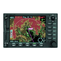
DECLUTTERING THE MAP
Two LSKs along the left edge of the display allow for separate control
of the information density of the land-based (“Land”) map features
(e.g. terrain, political boundaries, rivers, lakes, oceans, roads, etc.)
and the navigational-based (“Nav”) map features (e.g. airspace,
Victor and Jet airways, airports, obstacles, navaids, etc.).
Use the “Land” and/or “Nav” LSK to select the preferred level of
feature density. The level specified remains consistent across all
map pages on the display on which it was set.
Map Declutter Controls