AeroNav 900/880 Series Pilot’s Guide
89000039-010
5-32 Aux Subsystem Rev 1 May 2019
Datablock Item Title
and Image
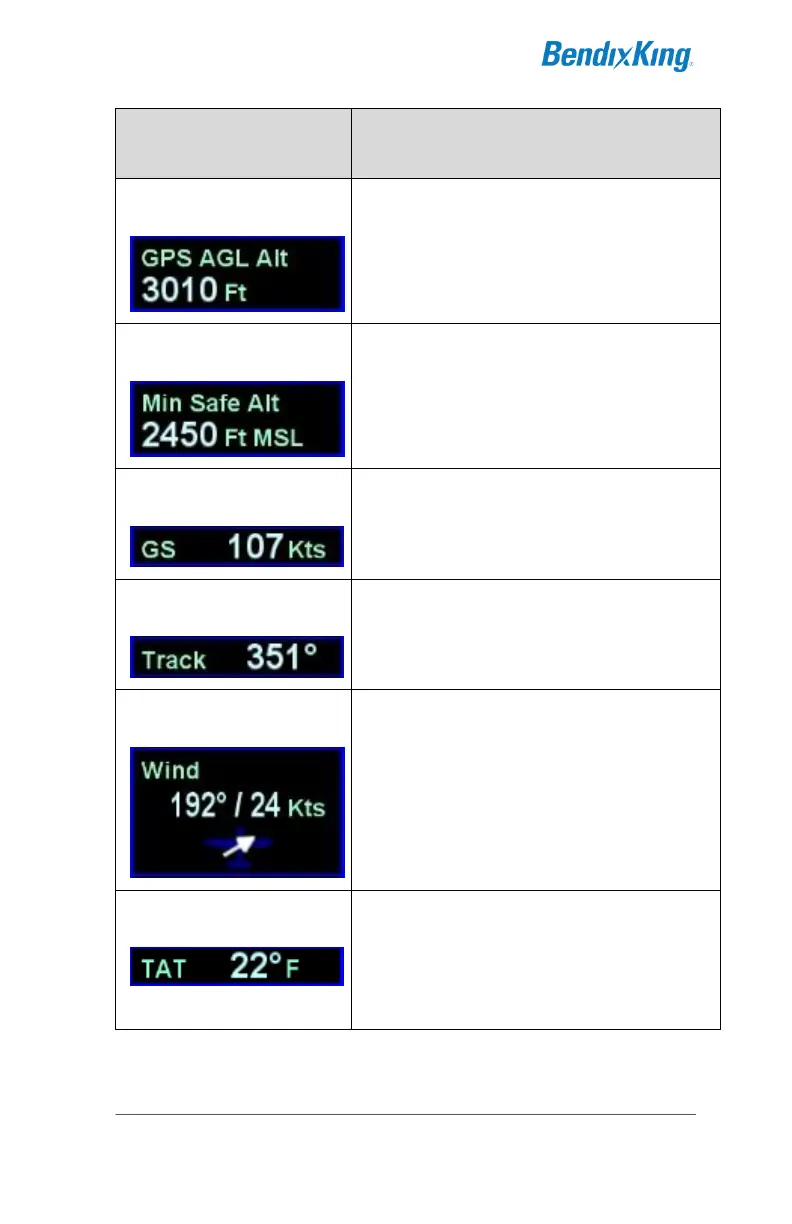
Computed GPS-based AGL altitude. (2
lines on side, 1 line on top)
Min Safe Altitude (defined as 1000’
above the highest terrain or obstacle in
a 10nm rectangle around ownship
position). (2 lines on side, 1 line on
top)
Wind speed and direction, and an
arrow indicating direction of the wind
relative to the nose of the airplane.
Populates in air. Displays as “Calm”
when 5 knots or less. (3 lines)
Note: Requires TAS and Heading
from an external device like an EFIS.
Total Air Temperature (1 line)
Note: Requires TAT input from an
external device like an EFIS or
appropriate fuel flow system.