787 Flight Crew Operations Manual
DO NOT USE FOR FLIGHT
Flight Instruments, Displays -
Controls and Indicators
Copyright © The Boeing Company. See title page for details.
10.10.36 D615Z003-TBC
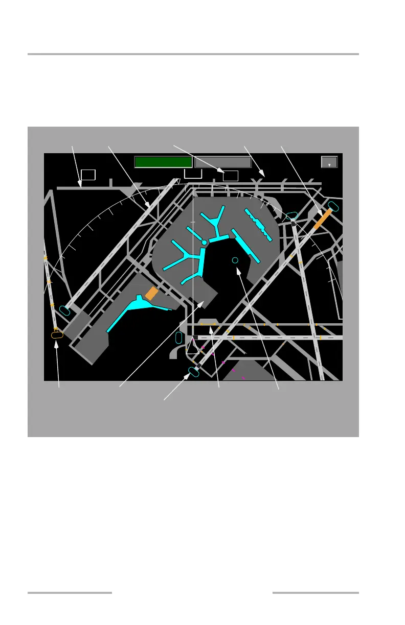
Airport Map Display
The Airport Map is integrated with the ND. The Airport Map automatically
displays at ranges of 5 NM or less if the airport is either the ORIGIN or
DESTINATION airport in the active flight plan.
[Option – Track up]
The INFO display shows the effectivity dates for the airport map database. The
INFO display can be selected from any of the Display Select Panels or lower
display switches on the Multi-Function Keypads.
TRK MAG
233
0021/ 0
TAS50
P4
H
P
AB
A
P
V1
H
H1
C
E
A19
A20
A21
R
A13
A14
A15
A17
A11
A10
A9
A8
A6
A5
A4
E
E
E
A
T12
T11
P3
2
R
H
R
A
J
F
S
D8
D5
D4
S
C
KORD
G
T
OSD
00.0z
0.0
NM
V2
H3
V
32R
D3
D2
D1
B
A18
M5
M4
M3
2
7
R
2
2
L
2
7
L
9
L
4
L
T9 T8 T7 T6 T5
S3
F
T
M
A
F
H2
T
A
T
B
B
R
B
GPS
G
E
J
J
T10
M5
B
M2
J1
W
BB
F
D7
D6
PLAN
MENU
MAP
KORD
DE-ICE
DE-ICE
1
8
2
4
3
0
2
1
2
7
0.5
RANGE
1
NAVIGATION DISPLAY
Runway Label
Taxiway
Construction Area
De-icing Area
Taxiway Label Runway
Partially Closed
Taxiway
Airport Identifier
Closed
Runway
ICAO ID
February 15, 2010