787 Flight Crew Operations Manual
DO NOT USE FOR FLIGHT
Flight Instruments, Displays -
Navigation Displays
Copyright © The Boeing Company. See title page for details.
10.40.18 D615Z003-TBC
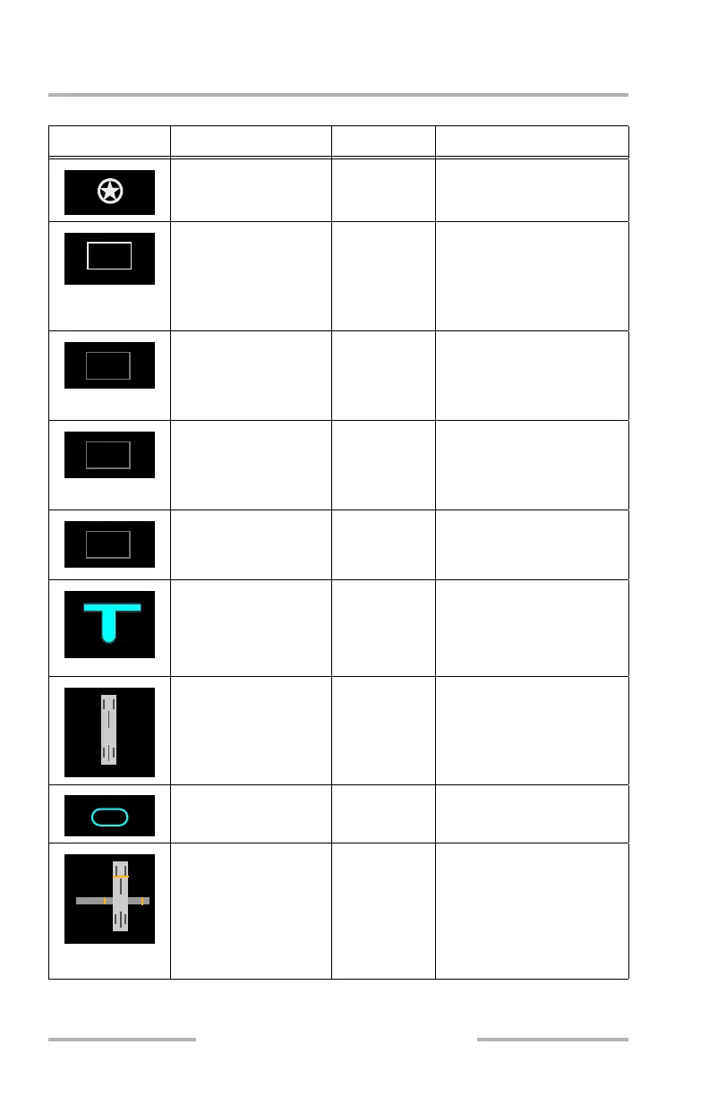
Airport Map
Symbol Name ND Mode Remarks
Airport beacon (W) MAP, MAP
CTR, PLAN
Displayed at ranges 2, 1,
and 0.5 NM.
ICAO ID (W) MAP, MAP
CTR, PLAN
Airport ICAO Identifier in
GRID Heading box.
Displayed at all ranges
except when in GRID
Heading.
LOAD message (W) MAP, MAP
CTR, PLAN
Displayed at all ranges
during delay between
execution of flight plan and
display of airport map.
DATE message (W) MAP, MAP
CTR, PLAN
Displayed at all ranges
when active cycle of
Airport Map database is
expired or out of range.
WXR ON message
(W)
MAP, MAP
CTR, PLAN
Displayed at all ranges
when WXR switch is
selected.
Concourse and gates
(C)
MAP, MAP
CTR, PLAN
Concourse is displayed at
ranges 2, 1, and 0.5 NM.
Gates are displayed at a
range of 0.5 NM.
Runway MAP, MAP
CTR, PLAN
Displayed at ranges 5, 2, 1,
and 0.5 NM.
Runway identifier (W,
C)
MAP, MAP
CTR, PLAN
Displayed at ranges 2, 1,
and 0.5 NM.
Taxiway holding
position, land and hold
short line (A)
MAP, MAP
CTR, PLAN
Taxiway holding position
displayed at ranges 1 and
0.5 NM.
Land and hold short line
displayed at ranges 2, 1,
and 0.5 NM.
KORD
<
ICAO
>
LOAD
<
ICAO
>
DATE
<
ICAO
>
WXR ON
C4
C5
C6
C7
C8
32R
August 14, 2009