787 Flight Crew Operations Manual
DO NOT USE FOR FLIGHT
Flight Instruments, Displays -
Navigation Displays
Copyright © The Boeing Company. See title page for details.
D615Z003-TBC 10.40.19
Vertical Situation Display (VSD)
Symbol Name ND Mode Remarks
Closed runway
indications (A)
MAP, MAP
CTR, PLAN
Displayed at ranges 5, 2, 1,
and 0.5 NM.
Partially closed
runway indications
(A)
MAP, MAP
CTR, PLAN
Displayed at ranges 5, 2, 1,
and 0.5 NM.
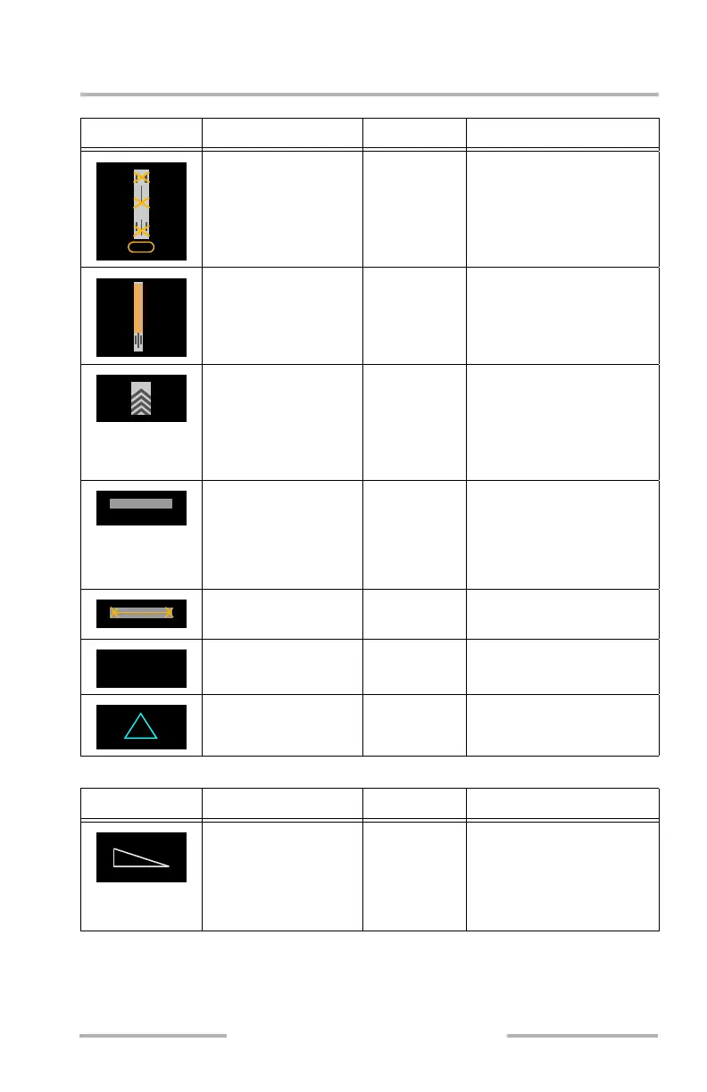
Stopway / blast pad,
stopway chevrons
MAP, MAP
CTR, PLAN
Stopway / blast pad
displayed at ranges 5, 2, 1,
0.5 NM.
Chevrons displayed at
ranges 2, 1, 0.5 NM.
Taxiway and taxiway
identifier
MAP, MAP
CTR, PLAN
Taxiway is displayed at
ranges 5, 2, 1, 0.5 NM.
Taxiway identifier is
displayed at ranges 2, 1,
and 0.5 NM.
Closed taxiway
indications (A)
MAP, MAP
CTR, PLAN
Displayed at ranges 2, 1,
and 0.5 NM.
De-icing area (W) MAP, MAP
CTR, PLAN
Displayed at ranges 1 and
0.5 NM.
Helicopter landing
area (W, C)
MAP, MAP
CTR, PLAN
Displayed at ranges 1 and
0.5 NM.
Symbol Name ND Mode Remarks
Airplane symbol (W) MAP, MAP
CTR
Current airplane altitude is
the bottom of the triangle.
Current airplane lateral
position relative to terrain
is the point of the triangle.
32R
G
DE-ICE
H
February 15, 2010