Title Planning and Riding a Course
Identifier GUID-AB1BC8CE-AD01-40E5-AF83-B1590443166E
Language EN-US
Description
Version 2
Revision 3
Changes Added a tip for adding multiple points from the map.
Status Released
Last Modified 27/06/2018 09:28:03
Author cozmyer
Planning and Riding a Course
You can create and ride a custom course. A course is a sequence of waypoints or locations that leads you to
your final destination.
1 Select Navigation > Courses > Course Creator > Add First Location.
2 Select an option:
• To select your current location on the map, select Current Location.
• To select a saved location, select Saved, and select a location.
• To select a location for which you recently searched, select Recent Finds, and select a location.
• To select a location on the map, select Use Map, and select a location.
• To browse for and select a point of interest, select POI Categories, and select a nearby point of interest.
• To select a city, select Cities, and select a nearby city.
• To select an address, select Addresses, and enter the address.
• To select an intersection, select Intersections, and enter the street names.
• To use coordinates, select Coordinates, and enter the coordinates.
3 Select Use.
TIP: From the map, you can select another location, and select Use to continue adding locations.
4 Select Add Next Location.
5 Repeat steps 2 through 4 until you have selected all locations for the route.
6 Select View Map.
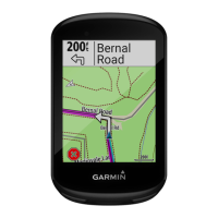
The device calculates your route, and a map of the route appears.
TIP: You can select to view an elevation plot of the route.
7 Select Ride.
54 Navigation
 Loading...