OW70L-Dac - OneWeb LEO User Terminal
26
5.4.4 Measuring the North point
It needs to calibrate declination angle due to the difference between Magnetic North and True North.
It is recommended to perform with antenna mounting at the same time.
A. When using a magnetic compass
1. Measure the orientation of the magnetic north by using a compass.
2. Mark the magnetic north point.
3. Get the magnetic declination angle at the installation area by the calculator (Refer to the Magnetic Field
Calculators on the National Oceanic and Atmospheric Administration (NOAA)
website www.ngdc.noaa.gov).
4. Mark the True North point on the mounting plate by including the declination angle.
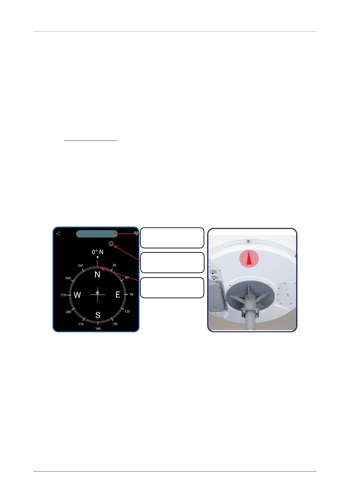
B. When using a GPS compass (To assist in better alignment of the User Terminal)
1. Check the orientation of the True North indicator.
2. Extending its virtual line from the centre of the User Terminal to the Tip of the True North indicator (Line)
by using your own GPS compass (Smart phone applications or devices).
3. Compare with virtual line and “Red triangle” on the bottom of radome to check any misalignment.
Refer to the below App screen as a reference.
TRUE NORTH
Current Location
Set your
“Current Location”
Check the
“True North”
Find the
“True North” point

 Loading...