Chapter 4 Menu operations MDC-2200/2500 Series
0093125002-05 4-40
(22) Select COAST LINE/GPS BUOY
This radar is provided with functions to produce coast line by itself and to display GPS buoys.
The both of them cannot be used simultaneously and either one of them shall be used.
With this item, the function to use shall be selected.
(23) Using of COAST LINE
When COAST LINE has been selected in (22), this can be used.
A coast line is a line consisting of 50 points (called as 1 block) and total 20 lines can be produced. For
each point, latitude and longitude shall be input.
(24) Using of GPS buoys
When GPS BUOY has been selected in (22), this can be used.
GPS buoys can be used when GPS buoy transmitter/receiver made by TAIYO MUSEN is connected to
the display and buoy information sentences (BLV) is received.
Buoy IDs can be recorded up to 10 kinds.
Time, position and water temperature up to 100 points can be recorded per 1 ID. In the latest data, in
addition to time, position and water temperature, course, speed and battery voltage can be recorded.
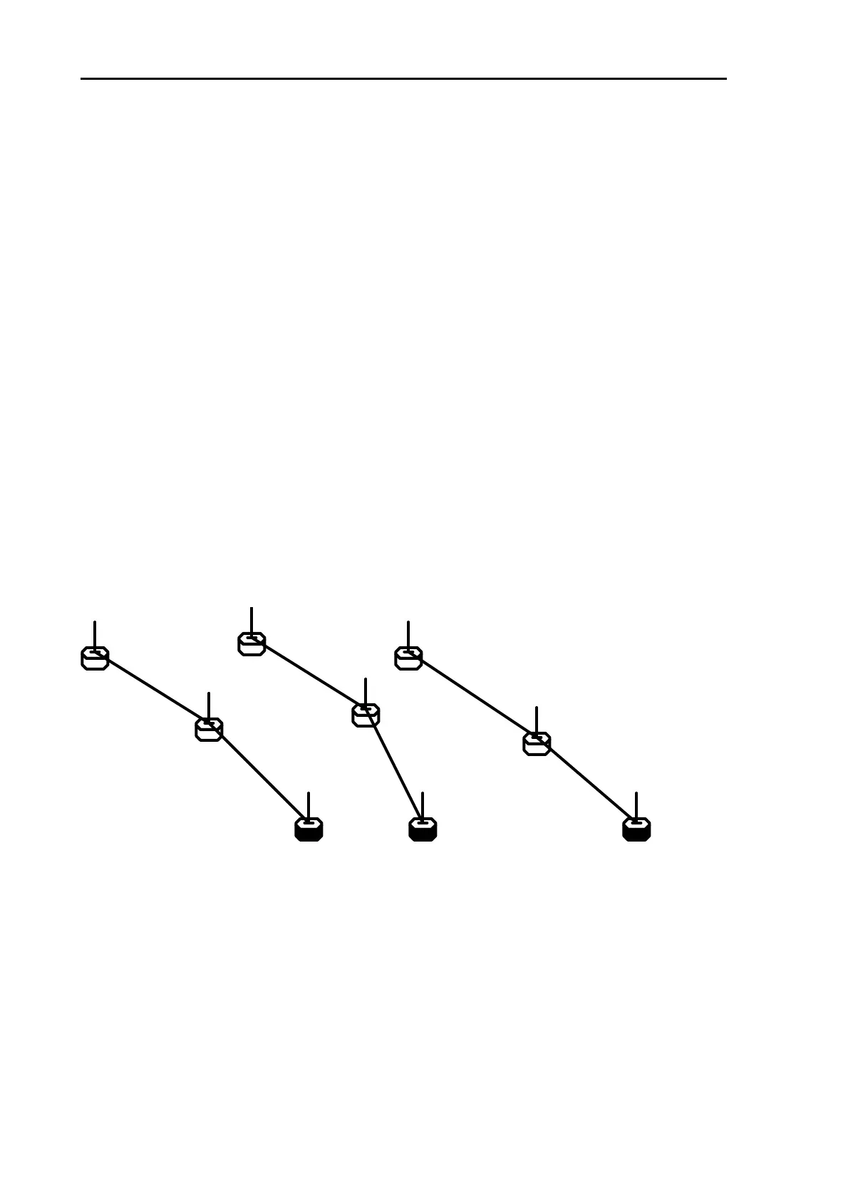
Examples of display:
1
24.2
55
0.0
99
-3.3
23.8
0.6
-8.3
22.4
0.8
-12.3
Buoys with same ID will be displayed linked with straight lies. Under each buoy symbol, water
temperature can be indicated.
The latest data will be indicated with marked-out symbols, and ID can be also indicated at the right
hand side of the symbol as shown in the above examples.