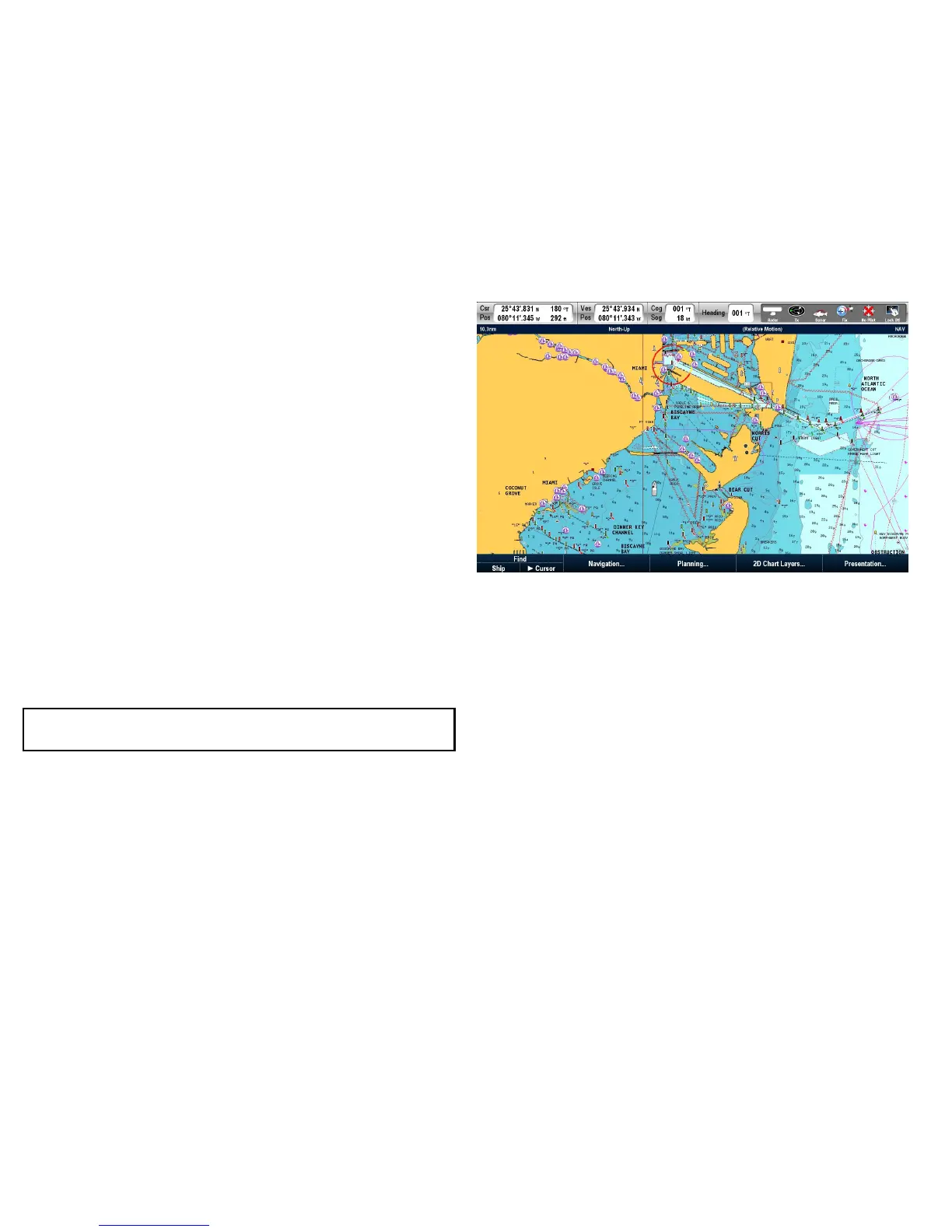
6.1Chartapplicationoverview
Thechartapplicationprovidesanelectronicchartwithpassage
planningandnavigationfeatures.Itcombines2Dand3Dviewpoints
andprovidesavarietyofcartographicinformationregardingyour
surroundingsandchartedobjects.
Typicalusesforthechartapplicationinclude:
•Monitoryourvessellocationandheading.
•Interpretyoursurroundings.
•Measuredistanceandbearing.
•Navigateusingwaypoints.
•Plan,andNavigateusingroutes.
•Monitorxedandmovingobjectsusingradaroverlay.
•MonitorvesselsinyourvicinityusingAISdata.
•Keeptrackandrecordyourcourse.
•Viewinformationforchartedobjects.
•OverlayNOWRadweatherinformation.
•Overlayaerialphotosandotherchartenhancements
Note:T oobtainfull3Ddetail,youmusthavechartcards
containing3Dcartographyfortheappropriategeographicarea.
Youcanalsouseyourmultifunctiondisplaytocustomizeyourchart
applicationtoyourownparticularrequirementsandcircumstances.
Youcan:
•Alterthewaythechartisdrawninrelationtoyourvesselandthe
directionyouaretravellingin(chartorientationandmotionmode).
•Manageandeditchartdatayouhaveentered.
•Controlthelevelofdetaildisplayedon-screen.
Multipleapplications
Withmostapplications,itispossibletorun4instancesofthesame
applicationatanyonetime.Howeverthereare2exceptionsto
this,whichare:
•Chartapplication—maximum2simultaneousinstancesper
multifunctiondisplay.
•Siriussatelliteradioapplication—maximum1instanceper
multifunctiondisplay,atanyonetime.
•Videoapplication—maximum1instancepermultifunction
display,atanyonetime.
Chartdatum
Thechartdatumsettingaffectstheaccuracyofthevesselposition
informationdisplayedinthechartapplication.
70E-SeriesWidescreenUserreference

 Loading...