ItemDescription
6
Cartographicobjects—usetheCartographySetupmenu
tochoosewhichobjectstodisplay.
7
AIStarget—avesselbroadcastingAISinformation.
8
Charttype—indicatesthetypeofchartinuse—Fishor
Navigation.
9
Statusbar—displaysthestatusofexternallyconnected
equipment.
3Dchartview
The3Dchartviewincludesanumberoffunctionstohelpyou
navigateyourvessel.
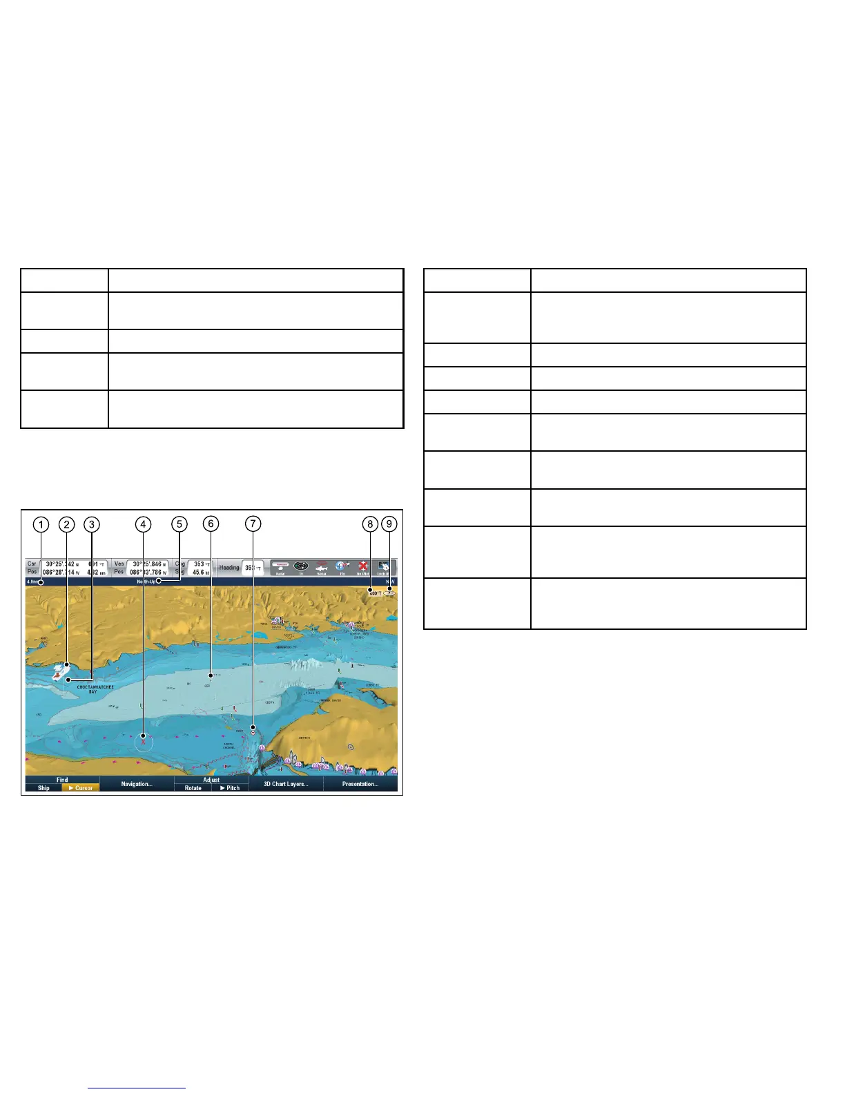
ItemDescription
1
Range—horizontaldistanceacrossscreen(halfway
upthewindoworatcenterofview).Showninselected
systemunits.
2Vesselsymbol—yourvessel’scurrentposition.
3
DepthScale—approximatedepthbeneathyourvessel.
4Waypoint—witharrivalcircle.
5
Orientation—statestheorientationmodethatthechart
isusing.
6
Center-of-view—thewhitecrossindicatesthecenter
ofchartviewatthewaterlevel.
7
Cartographicobjects—usetheCartographySetup
menutochoosewhichobjectstodisplay.
8
Rotation—showsindegreestrue,howfarthe
on-screenviewhasbeenrotatedfromyourvessel’s
heading.
9
Northarrow–3DindicationofTrueNorthinrelation
tothechartview.Thenortharrowalsotiltstoindicate
pitchangle.
Manipulatingthechartview
UseacombinationoftheUniControlandrangekeystomanipulate
thechartview.
76E-SeriesWidescreenUserreference

 Loading...