CHAPTER 2 CONTROLS AND DISPLAY
EFD1000 VFR PFD Pilot’s Guide
Page 2-28
091-00028-001 ( )
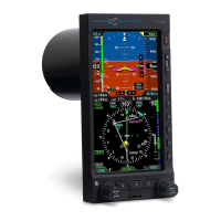
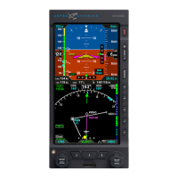
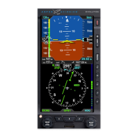
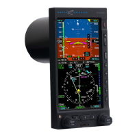
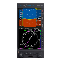
2.3.4. Navigation Display
The lower half of the PFD is the Navigation Display (Table 2-8 and Figure 2-35), which
shows a wide range of navigation information and ight data, including:
• Course Pointer and Heading Bug.
• 360° and ARC Compass rose display modes.
• Numeric displays of current magnetic heading, selected heading (HDG), and
selected course (CRS).
• Information about the selected CDI navigation source, or active GPS waypoint.
• Ground Track Marker.
• Vertical Speed Indicator (VSI) tape and numerical rate value.
• Rate of Turn Indicator.
• Situational Awareness Map display.
• Course Deviation Indicators (CDI) , navigation source information.
• GPS annunciations (TERM, WPT, and MSG).
• Caution annunciations for abnormal GPS status.
When connected to a GPS navigator, basic mapping can also be displayed including
GPS ight plan legs and waypoints, (and when connected to a compatible GPS)
Basemap data (airports, VORs, NDBs, and intersections).