787 Flight Crew Operations Manual
DO NOT USE FOR FLIGHT
Flight Instruments, Displays -
Controls and Indicators
Copyright © The Boeing Company. See title page for details.
10.10.32 D615Z003-TBC
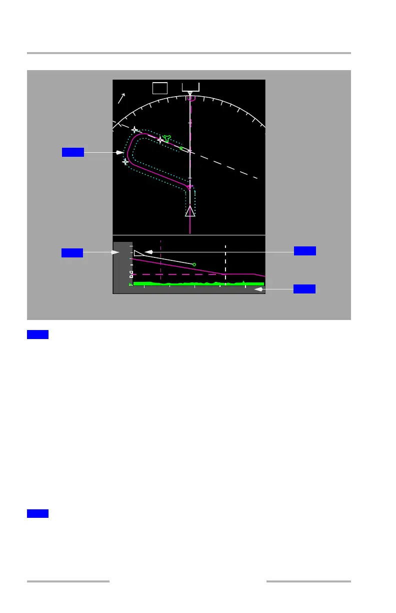
[Option – Track up]
Displayed (cyan) – indicates area mapped by the VSD.
Track mode (default) – Dashed lines are offset by 1 RNP from instantaneous track
of airplane.
Route mode – Dashed lines are offset by 1 RNP from the Flight Management
Flight Plan. Automatically selected when:
• airplane is on ground –
• an active flight plan has been entered and
• a departure runway has been selected and
• LNAV is armed
• airplane is in air –
• airplane is in any path-based mode such as LNAV, LOC, or FAC, and
• lateral path deviation is less than RNP
Displays altitude in reference to the vertical position of the airplane symbol,
terrain, and other objects in the VSD background display.
During QFE operations, the altitude reference scale is shaded green the same as
the PFD altitude scale..
1
VSD Corridor
2
Altitude Reference Scale
100
3
VASHO
20
TERR
341
o
NM
11.6
1154.3z
VASHO252
RANGETAS
/ 0
251
GS
PARKK
IBFI
E/O
1900
ALKIA
3200
ANVIL
3200
VASHO
10
3
6
9
051
TRK MAG
3200
ALKIA
4
8
12
000
000
000
000
0
10
20
ROUTE MODE
2
3
4
1
February 15, 2010