Title Map Tools
Identifier GUID-9DCBF296-FA93-4679-9B32-3EC299623D74
Language EN-US
Description
Version 14
Revision 8
Changes Added Pitch and Roll, Group Ride, and Radio
Status Released
Last Modified 15/02/2021 15:01:34
Author hizerdanielle
Map Tools
Map tools provide quick access to information and device functions while you view the map. When you activate
a map tool, it appears in a panel at the edge of the map.
Stop: Stops navigation of the active route.
Edit Route: Allows you to take a detour or skip locations in your route (Changing Your Active Route, page 90).
Mute: Mutes the device audio.
Cities Ahead: Shows upcoming cities and services along your active route or along a highway (Cities Ahead,
page 44).
Up Ahead: Shows upcoming locations along the route or the road on which you are traveling (Up Ahead,
page 42).
Elevation: Displays elevation changes ahead.
Traffic: Displays traffic conditions along your route or in your area (Viewing Upcoming Traffic, page 47). This
feature is not available in all areas or for all device models.
Trip Data: Displays customizable trip data, such as speed or mileage (Viewing Trip Data from the Map,
page 45).
Track Recorder: Displays the track data for your active route.
Turns: Displays a list of upcoming turns in your route (Viewing Turns and Directions, page 88).
Phone: Displays a list of recent phone calls from your connected phone, and displays in-call options while a
phone call is active (Using In-Call Options, page 81).
Weather: Displays weather conditions for your area.
Report Safety Camera: Allows you to report a speed or red light camera. This tool is available only when you
have speed or red light camera data on your device and you have an active connection to the Tread app
(Pairing Your Phone and Headset, page 76).
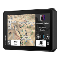
Music Player: Displays media controls and media information.
Pitch and Roll: Displays the current angle of your vehicle (Pitch and Roll, page 24).
Group Ride: Displays the distance and direction of the members in your group ride (Group Ride, page 27).
Radio: Allows you to use the push-to-talk feature with a compatible Bluetooth headset (Enabling Push-to-Talk
with a Headset, page 35).
Using the Map 41