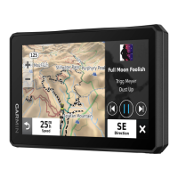
Title Downloading BirdsEye Imagery (zumo)
Identifier GUID-98109A68-8513-4327-8456-2044B21ED56A
Language EN-US
Description
Version 2
Revision 3
Changes Updating the path for Tread
Status Released
Last Modified 15/10/2021 09:37:56
Author hizerdanielle
Downloading BirdsEye Imagery
Before you can download BirdsEye imagery directly to your device, you must connect to a wireless network
(Connecting to a Wi‑Fi Network, page 137).
1 Select > BirdsEye Direct.
2 Select .
3 Select an option:
• To download BirdsEye imagery files for a specific location or area, select Location, and select a category.
NOTE: The location defaults to your current location.
• To select an image quality option, select Detail.
• To define the size of the area to be shown in the downloaded imagery files, select Size, and enter a
distance from the selected location.
• To select where to save the downloaded imagery, select Save To.
4 Select Download.
5 Enter a name for the downloaded imagery and select Done.
Title Route Planner
Identifier GUID-BA76112B-92B1-4BF4-8328-E3D6332644A4
Language EN-US
Description
Version 1
Revision 6
Changes Save as from Trip Planner.
Status Released
Last Modified 31/03/2021 12:51:28
Author burzinskititu
Route Planner
You can use the route planner to create and save a route, which you can navigate later. This can be useful for
planning a delivery route, a vacation, or a road trip. You can edit a saved route to further customize it, including
reordering locations, adding suggested attractions, and adding shaping points.
You can also use the route planner to edit and save your active route.
54 Using the Apps