2-8 Raychart 425 Chartplotter
2. If further chart enlargement is available using the current chart card
you can press the bottom of the
RANGE key to zoom in again, reposi-
tioning the cursor first if required.
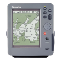
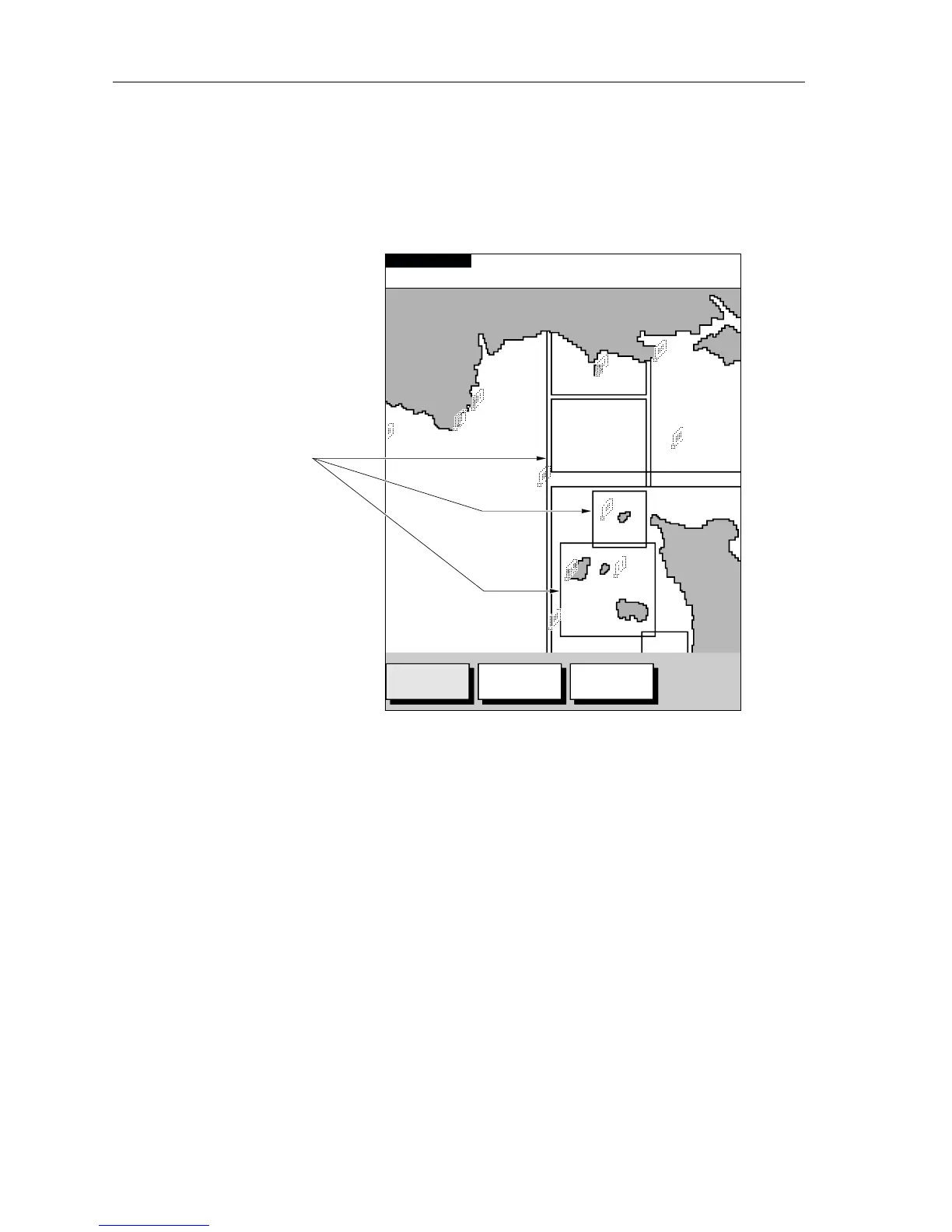
An area of further chart detail is indicated by a box around the area as
shown in Figure 2-6.
Figure 2-6: Chart Detail Boundaries
3. If no further chart detail is available then, when the bottom of the
RANGE key is pressed, the result depends upon whether Plotter Mode
is on or off:
• If Plotter Mode is Off, the chart scale remains unchanged, indicat-
ing that the greatest detail is displayed.
• If Plotter Mode is On, the scale is decreased but, as there is no fur-
ther detail, the vessel, waypoints, routes and tracklines are dis-
played without cartography.
The chart information is restored when you return to a chart scale for
which the information is available.
➤ To zoom out to a less detailed chart, press the top of the RANGE key as
many times as required.
TOPSHAM
EXETER
TEIGNMOUTH
EXMOUTH
TORQUAY
DARTMOUTH
PLYMOUTH
ENPORT
SALCOMBE
PORTLAND
HARBOUR
ISLE O
CAP DE
LA HAGUE
ALDERNEY
GUERNSEY
JERSEY
PORTB
CSR 48°30.367'N
POS 1°35.636'W
128 nm
FIND SHIP ROUTES WAYPOINTS
BRG 231°T
RNG 40.91nm
D4988_2
SIM NU
Chart Boundary -
Indicates further
detail is available inside.
Shown when using
Navionics
®
Nav-Chart
card.
 Loading...