MANUAL – REFLEX EZ-TRAC™ | 94
15 Terminology
The terminology within the drilling industry is not uniform. This
chapter provides explanations to the terminology used by
REFLEX™.
Concepts and terms used in this manual are illustrated in the figure
below.
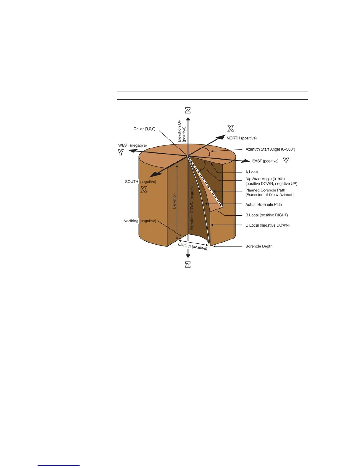
Figure 99 Reflex terminology
X-axis The x-axis represents the north-south direction in an optional
geographical coordinate system. The starting x-point may be set to
zero, or to the local north/south coordinate as measured with e.g. a
theodolite. North is normally the positive direction.
Y-axis The y-axis represents the east-west direction in an optional
geographical coordinate system. The starting y-point may be set to
zero, or to the local east/west coordinate as measured with e.g. a
theodolite. East is normally the positive direction.
Elevation UP/DOWN The z-axis represents the elevation in an optional geographical
coordinate system. The starting elevation may be set to zero, or to
the local elevation as measured with e.g. a theodolite. In the
REFLEX™ EZ-COM unit, the elevation convention is positive upwards.
The elevation convention (positive upwards or downwards) can be
changed in
REFLEX™ SProcess.
Azimuth Azimuth is the borehole direction measured from north against east,
expressed as an angular distance. The azimuth angle range is
0-360°.