To collect points in a track, select the play key and start moving along the desired track. Select
the pause key as needed and select play to start again. Current position information, total
distance, altitude change, and points in the track are collected.
When you are finished, select the stop key. A dialogue box is shown with the track name. You
can use that name or edit it. Select the check mark when you are finished. The track is saved in
\My Documents\My Tracks.
Select the edit icon to add or edit the name, description, notes, and file type for this track
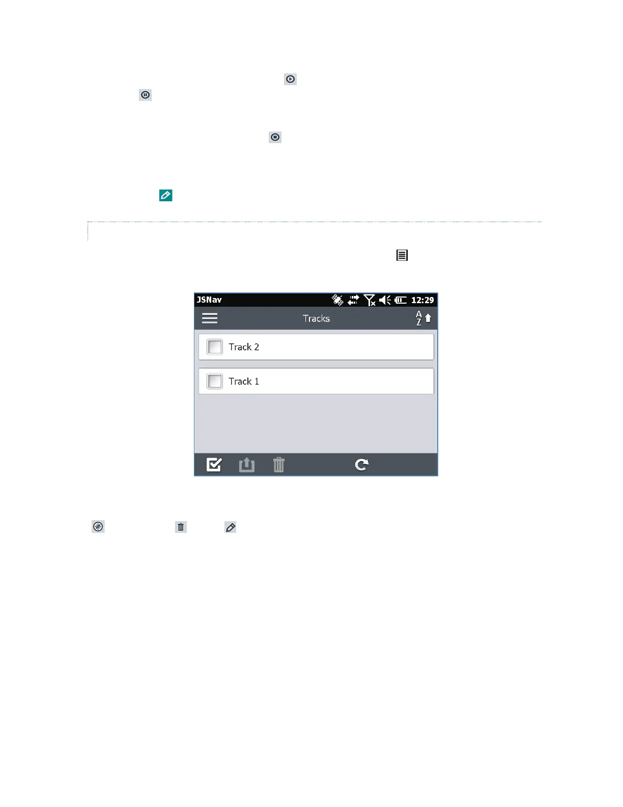
MANAGE WAYPOINTS AND TRACKS
To view the waypoints and tracks you have saved, select the menu icon, then select Waypoints
or Tracks from the menu. A list of waypoints or tracks is shown.
To open a file, select the name. You can view collected data, select the file for exporting or
deletion by selecting the box to the left of the name, navigate back to the waypoint or track points
, delete the file , or edit the file.
 Loading...