6. Survey with LandStar 6 software
i80 GNSS Receiver User Guide Page 65
site calibration and the coordinates measured will be transformed
automatically into local grid coordinates.
If a projection and datum transformation have already been
specified, users can reduce any discrepancies between the WGS-84
coordinates and the local grid coordinates by performing a site
calibration.
To perform the site calibration, users need to measure the control
points with GNSS receiver first.
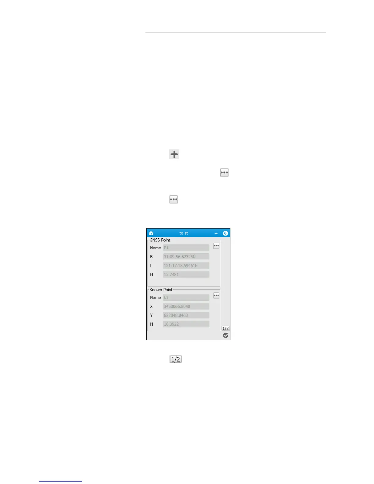
To perform site calibration:
1. In the main menu, tap Survey → tap Point Adjust.
2. Tap button in the lower left corner to add point pair(s).
3. In the pop-up screen, tap button on the upper side of the screen
to add the existing GNSS point or key in a GNSS point.
4. Tap button on the lower side of the screen to add the existing
known point or key in a known point.
5. Tap button to go down to the bottom of the page.
6. Select the adjustment method from the dropdown list next to Method
field.