6. Survey with LandStar 6 software
i80 GNSS Receiver User Guide Page 55
Code field: enter the code of the point, if required.
CRS field: select the coordination system from the dropdown list. The
available options are: Local and WGS84.
Role field: select the role of the point from the dropdown list. The
available options are: Null, To Stake Out and Control.
X, Y, H field: enter the local grid coordinate of the point.
3. Tap button in the lower right corner of New point screen to save
the point.
6.3. MEASURE POINTS
Note – To ensure the accuracy of the coordinates measured, please perform
measurements after the rover receiver receives correction data (with
correction LED flashes once per second) and gets fixed solution.
6.3.1. MEASURE POINTS IN CONVENTIONAL MODE
1. In the main menu, tap Survey → tap Point Survey.
2. Enter the point name in the input frame on the top left corner.
Notes
The system will automatically increment the numeric component of
the measured point name.
The measured points will be automatically incremented from “P1”,
by default.
3. If necessary, enter the feature code in the input frame on the top right
corner.
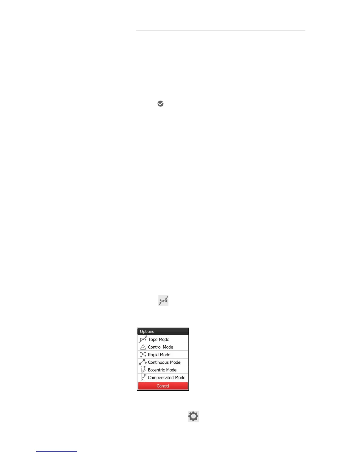
4. Tap button to select a measurement mode in the pop-up
window.
Notes
Users can tap button to configure the settings of each