i80 GNSS Receiver User Guide Page 51
6. SURVEY WITH LANDSTAR 6 SOFTWARE
The CHC Landstar 6 Software (“LandStar 6”) is a field survey software which
developed based on more than ten years of development experience of CHC
and feedback of surveyors from different fields of application. LandStar 6
provides with a complete set of features for any survey projects, including
data collection, stakeout, COGO (Coordinate Geometry) function, and more,
which makes this software an ideal option for everyday field work.
This chapter briefly introduces the basic survey workflows of LandStar 6,
combining with i80 GNSS receiver.
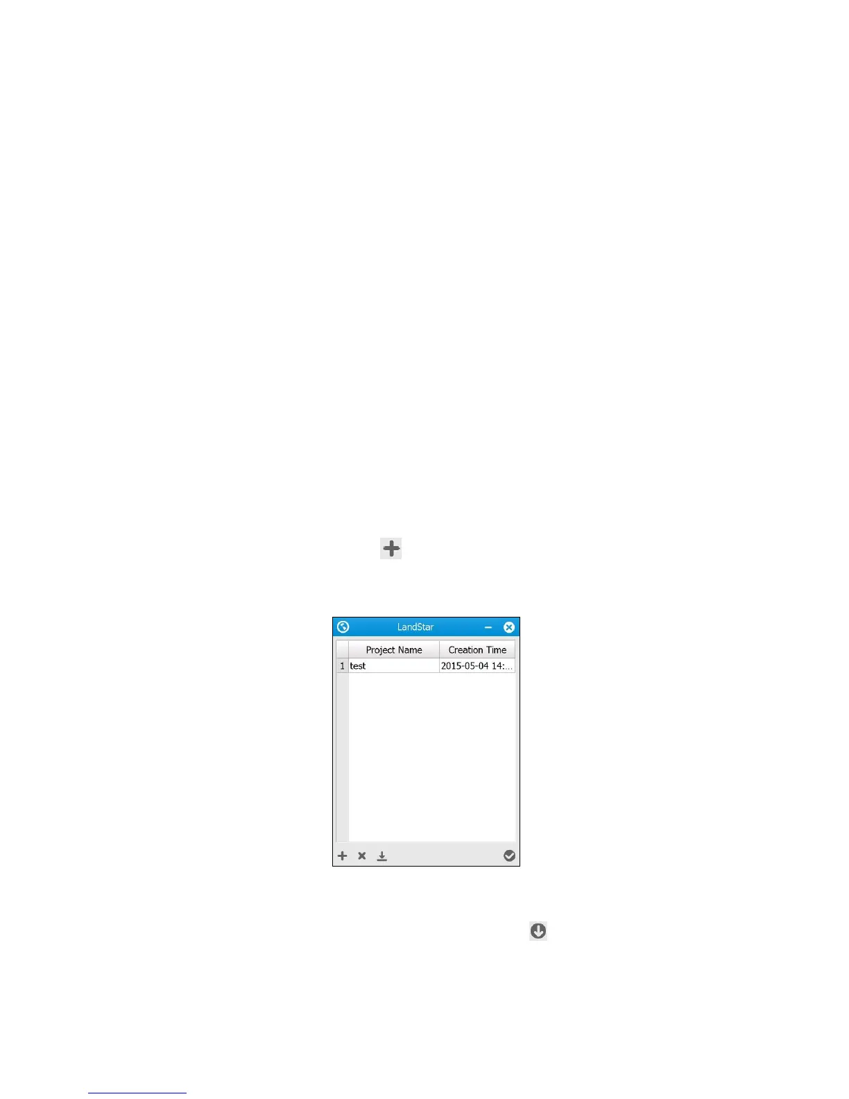
6.1. NEW PROJECT
Turn on the controller, run LandStar 6 software and establish the connection
with receiver via Bluetooth or Wi-Fi (see 2.7. Connecting to a controller for
the operations), and then create a new project or open an existing project
before measuring any points, or making any calculations.
To create a new project:
1. Tap button on the lower left corner of the initial interface that the
LandStar 6 starts with.
2. Enter the Project name and Create by (operator), select Time zone from
the dropdown list, and then tap button.